
IMAGES TAKEN NEAR TO
Bennetts Road, BATH, BA1 7AW
Introduction
This page details the photographs taken nearby to Bennetts Road, BA1 7AW by members of the Geograph project.
The Geograph project started in 2005 with the aim of publishing, organising and preserving representative images for every square kilometre of Great Britain, Ireland and the Isle of Man.

There are currently over 7.5m images from over14,400 individuals and you can help contribute to the project by visiting https://www.geograph.org.uk
Image Map
Images are licensed for reuse under creativecommons.org/licenses/by-sa/2.0
Notes
- Clicking on the map will re-center to the selected point.
- The higher the marker number, the further away the image location is from the centre of the postcode.
Image Listing (32 Images Found)
Images are licensed for reuse under creativecommons.org/licenses/by-sa/2.0
Image
Details
Distance
1
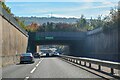
Swainswick : A46
Looking along the A46.
Image: © Lewis Clarke
Taken: 18 Oct 2022
0.07 miles
2
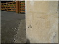
Benchmark on the old Tollhouse
A cutmark, as listed in the Benchmark Database: http://www.bench-marks.org.uk/bm78608 , on the front of the traditionally octagonal part of the old Tollhouse on the Gloucester Road. The mark is a new one, dating from the post-WWII era and is a replacement for one cut in the nineteenth century. See Image] for a longer view of the house.
Image: © Neil Owen
Taken: 8 Sep 2016
0.08 miles

4
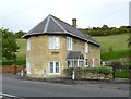
Tollhouse by Gloucester Road, Lower Swainswick
Tollhouse in the parish of Swainswick (Bath and North East Somerset District), Turnpike Cottage, Gloucester Road, Lower Swainswick, BA1 8BG.
Grade II listed.
List Entry Number: 1276998 https://historicengland.org.uk/listing/the-list/list-entry/1276998
Surveyed
Milestone Society National ID: AV.SWA
Image: © Alan Rosevear
Taken: 1 Nov 2013
0.08 miles
5
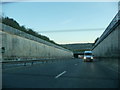
Bath : Batheaston Swainswick Bypass
A road leading into Bath and out to the rest of North Somerset
Image: © Lewis Clarke
Taken: 22 Oct 2008
0.08 miles
6

Slowing for Lower Swainswick
The old Gloucester Road indeed once used to be the main road to the north from Bath. Today it has been largely superseded by the newer dual carriageway not far from here. This has allowed the old tollhouse, with its octagonal profile, to enjoy a distinctly quieter life. See Image] for a benchmark on it.
Image: © Neil Owen
Taken: 8 Sep 2016
0.08 miles
7

Popping out the bales
A tractor and baler take advantage of the dry Spring.
Image: © Neil Owen
Taken: 8 Jun 2020
0.08 miles
8
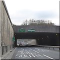
A46 underpass at Lower Swainswick
Approaching the junction with the A4
Image: © David Smith
Taken: 26 Nov 2016
0.09 miles
9

A46 tunnel, Lower Swainswick
Cut and cover construction, about 70 m long.
Image: © Robin Webster
Taken: 13 Nov 2022
0.09 miles
10
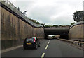
Overbridge over A46 near Lower Swainswick
First overbridge after the junction with the A4
Image: © John Firth
Taken: 4 Sep 2017
0.11 miles