Benchmark on the old Tollhouse
Introduction
The photograph on this page of Benchmark on the old Tollhouse by Neil Owen as part of the Geograph project.
The Geograph project started in 2005 with the aim of publishing, organising and preserving representative images for every square kilometre of Great Britain, Ireland and the Isle of Man.

There are currently over 7.5m images from over 14,400 individuals and you can help contribute to the project by visiting https://www.geograph.org.uk
Benchmark on the old Tollhouse
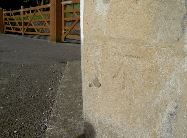
Image: © Neil Owen Taken: 8 Sep 2016
A cutmark, as listed in the Benchmark Database: http://www.bench-marks.org.uk/bm78608 , on the front of the traditionally octagonal part of the old Tollhouse on the Gloucester Road. The mark is a new one, dating from the post-WWII era and is a replacement for one cut in the nineteenth century. See Image] for a longer view of the house.
Images are licensed for reuse under creativecommons.org/licenses/by-sa/2.0
Image Location
Latitude
51.404138
Longitude
-2.342101