1
The Venue
Formerly the Centennial Centre, housing a variety of conference and event facilities.
Image: © Alan Murray-Rust
Taken: 21 Oct 2015
0.02 miles
2
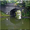
Canal at Icknield Port in Birmingham
The canal maintenance depot is off to the left, alongside the Edgbaston Reservoir.
This is on the Icknield Port Loop, a remnant of the original meandering main line engineered by Brindley, 1768-1772.
Image: © Roger Kidd
Taken: 26 Aug 2010
0.03 miles
3
Icknield Port Road
There is a bench mark http://www.geograph.org.uk/photo/4717194 on the bridge parapet to the left. The red panel is an emergency hatch to give access to the water of the canal for firefighting.
Image: © Alan Murray-Rust
Taken: 21 Oct 2015
0.03 miles
4
Bench mark, Icknield Port Road
See http://www.geograph.org.uk/photo/4717211 for location.
Image: © Alan Murray-Rust
Taken: 21 Oct 2015
0.03 miles
5
Icknield Port Loop, Birmingham Canal Navigations
Showing the Canal and River Trust maintenance yard with the dam of Edgbaston Reservoir behind. The spillway to the right is the feeder from the reservoir into the canal.
Image: © Alan Murray-Rust
Taken: 21 Oct 2015
0.03 miles
6
Former stable building by the Rotton Park Loop
Built around 1860 as a stable and grooms' room (for the young boys working the horses) on what was James Brindley's route of the canal. It's now a storage shed in the maintenance yard of the Canal and River Trust depot, and attracted a Grade II listing https://britishlistedbuildings.co.uk/101276288-stables-at-rotton-park-loop-canal-maintenance-yard-ladywood-ward#.XwX9-ChKjcs & https://historicengland.org.uk/listing/the-list/list-entry/1276288 in 1991.
Image: © Richard Law
Taken: 8 Jan 2020
0.03 miles
7
Icknield Port Road Wharf Bridge in Birmingham
This is on the Icknield Port Loop, a remnant of the original meandering main line to Wolverhampton engineered by Brindley, 1768-1772. https://en.wikipedia.org/wiki/Icknield_Port_Loop
The road crosses the canal twice, the other bridge 250 metres to the south-east sometimes being referred to as Osler Street Bridge.
Image: © Roger Kidd
Taken: 26 Aug 2010
0.04 miles
8
Icknield Port Road Wharf Bridge in Birmingham
This is on the Icknield Port Loop, a remnant of the original meandering main line to Wolverhampton engineered by Brindley, 1768-1772. https://en.wikipedia.org/wiki/Icknield_Port_Loop
The road crosses the canal twice, the other bridge 250 metres to the south-east sometimes being referred to as Osler Street Bridge.
Image: © Roger Kidd
Taken: 26 Aug 2010
0.04 miles
9
Covered dock building at the Rotton Park Loop yard
Dating from the middle of the 19th century, this covered dock building was given its own Grade II listing https://britishlistedbuildings.co.uk/101234111-covered-dock-at-rotton-park-loop-canal-maintenance-yard-ladywood-ward#.XwyVJChKjcs & https://historicengland.org.uk/listing/the-list/list-entry/1234111 in 1991, and is clearly still in regular use as a boat store.
Image: © Richard Law
Taken: 8 Jan 2020
0.04 miles
10
Icknield Port Loop by Edgbaston Reservoir, Birmingham
Looking north-west by the British Waterways Board (BWB) canal maintenance depot, and some of its boats.
Birmingham Canal Navigations. This loop is a remnant of the original meandering contour-hugging main line to Wolverhampton, which was built under supervision of James Brindley during 1768-1772. It is still used as a feeder channel from Edgbaston Reservoir to provide water for the new main line, engineered by Thomas Telford, and completed in stages between 1824 and (posthumously) 1838.
https://en.wikipedia.org/wiki/Icknield_Port_Loop
Current aerial images (2021) show that old buildings nearby have been demolished, and a derelict metal footbridge has been removed.
Image: © Roger Kidd
Taken: 26 Aug 2010
0.04 miles


