Icknield Port Loop by Edgbaston Reservoir, Birmingham
Introduction
The photograph on this page of Icknield Port Loop by Edgbaston Reservoir, Birmingham by Roger Kidd as part of the Geograph project.
The Geograph project started in 2005 with the aim of publishing, organising and preserving representative images for every square kilometre of Great Britain, Ireland and the Isle of Man.

There are currently over 7.5m images from over 14,400 individuals and you can help contribute to the project by visiting https://www.geograph.org.uk
Icknield Port Loop by Edgbaston Reservoir, Birmingham
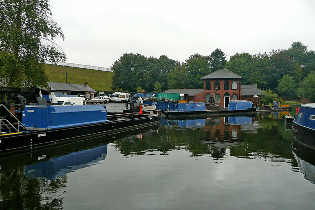
Image: © Roger Kidd Taken: 26 Aug 2010
Looking north-west by the British Waterways Board (BWB) canal maintenance depot, and some of its boats. Birmingham Canal Navigations. This loop is a remnant of the original meandering contour-hugging main line to Wolverhampton, which was built under supervision of James Brindley during 1768-1772. It is still used as a feeder channel from Edgbaston Reservoir to provide water for the new main line, engineered by Thomas Telford, and completed in stages between 1824 and (posthumously) 1838. https://en.wikipedia.org/wiki/Icknield_Port_Loop Current aerial images (2021) show that old buildings nearby have been demolished, and a derelict metal footbridge has been removed.
Images are licensed for reuse under creativecommons.org/licenses/by-sa/2.0
Image Location
Latitude
52.481085
Longitude
-1.933107