Covered dock building at the Rotton Park Loop yard
Introduction
The photograph on this page of Covered dock building at the Rotton Park Loop yard by Richard Law as part of the Geograph project.
The Geograph project started in 2005 with the aim of publishing, organising and preserving representative images for every square kilometre of Great Britain, Ireland and the Isle of Man.

There are currently over 7.5m images from over 14,400 individuals and you can help contribute to the project by visiting https://www.geograph.org.uk
Covered dock building at the Rotton Park Loop yard
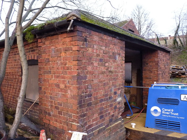
Image: © Richard Law Taken: 8 Jan 2020
Dating from the middle of the 19th century, this covered dock building was given its own Grade II listing https://britishlistedbuildings.co.uk/101234111-covered-dock-at-rotton-park-loop-canal-maintenance-yard-ladywood-ward#.XwyVJChKjcs & https://historicengland.org.uk/listing/the-list/list-entry/1234111 in 1991, and is clearly still in regular use as a boat store.
Images are licensed for reuse under creativecommons.org/licenses/by-sa/2.0
Image Location
Latitude
52.481085
Longitude
-1.933107