
IMAGES TAKEN NEAR TO
Maud, PETERHEAD, AB42 4QF
Introduction
This page details the photographs taken nearby to AB42 4QF by members of the Geograph project.
The Geograph project started in 2005 with the aim of publishing, organising and preserving representative images for every square kilometre of Great Britain, Ireland and the Isle of Man.

There are currently over 7.5m images from over14,400 individuals and you can help contribute to the project by visiting https://www.geograph.org.uk
Image Map
Images are licensed for reuse under creativecommons.org/licenses/by-sa/2.0
Notes
- Clicking on the map will re-center to the selected point.
- The higher the marker number, the further away the image location is from the centre of the postcode.
Image Listing (7 Images Found)
Images are licensed for reuse under creativecommons.org/licenses/by-sa/2.0
Image
Details
Distance
1
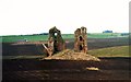
Fedderate castle
Fedderate once was a mighty castle with eight foot thick walls and approached by causeway across what was then marshland.In 1290 Magnus of Fedderate was one of the power brokers who recommended the marriage of the Maid of Norway to Edward.
Image: © Andrew Wood
Taken: 12 Mar 2004
0.16 miles
2
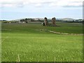
Fedderate Castle
The remains of this once mighty castle stand surrounded by fields. For further information see http://www.buchanweb.org/search.asp and search on "Fedderate Castle". See also http://www.pbase.com/rjmpaxman/image/49672626
Image: © Oliver Dixon
Taken: 21 May 2008
0.17 miles
3
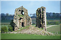
Fedderate Castle
Two rough stumps of masonry and a heap of rubble are all that remain of the castle of Fedderate. It was built by William Crawford, Baron of Fedderate. It is thought to date from the 15th century, and to have been defended by a moat and surrounding marshland, though here is nothing now left of the moat and causeway. See http://canmore.rcahms.gov.uk/en/site/19857/details/fedderate+castle/ and http://www.aberdeenshire.gov.uk/smrpub/shire/detail.aspx?refno=NJ84NE0001 for more detail.
Image: © Anne Burgess
Taken: 7 May 2015
0.17 miles
4
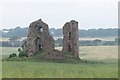
Fedderate Castle
The ruins are a B listed building. The castle was built around 1500 and occupied until the 18th century. The field of oats surrounding the ruin was once a marsh.
Image: © Richard Webb
Taken: 4 Aug 2011
0.17 miles
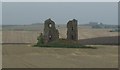
6
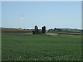
Fedderate Castle Ruins
Would have got a closer shot but the crop in the field was soaking wet!
For further information see http://www.buchanweb.org/search.asp and search on "Fedderate Castle".
Image: © Ken Fitlike
Taken: 24 May 2007
0.18 miles
7
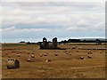
Fedderate Castle
Fedderate Castle amid a field of bales. Behind the ruin lies the Mains of Fedderate.
Image: © Andrew Wood
Taken: 11 Aug 2018
0.18 miles