Fedderate Castle
Introduction
The photograph on this page of Fedderate Castle by Anne Burgess as part of the Geograph project.
The Geograph project started in 2005 with the aim of publishing, organising and preserving representative images for every square kilometre of Great Britain, Ireland and the Isle of Man.

There are currently over 7.5m images from over 14,400 individuals and you can help contribute to the project by visiting https://www.geograph.org.uk
Fedderate Castle
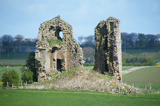
Image: © Anne Burgess Taken: 7 May 2015
Two rough stumps of masonry and a heap of rubble are all that remain of the castle of Fedderate. It was built by William Crawford, Baron of Fedderate. It is thought to date from the 15th century, and to have been defended by a moat and surrounding marshland, though here is nothing now left of the moat and causeway. See http://canmore.rcahms.gov.uk/en/site/19857/details/fedderate+castle/ and http://www.aberdeenshire.gov.uk/smrpub/shire/detail.aspx?refno=NJ84NE0001 for more detail.
Images are licensed for reuse under creativecommons.org/licenses/by-sa/2.0
Image Location
Latitude
57.538484
Longitude
-2.174031