IMAGES TAKEN NEAR TO
Raemoir, BANCHORY, AB31 5RN
Introduction
This page details the photographs taken nearby to AB31 5RN by members of the Geograph project.
The Geograph project started in 2005 with the aim of publishing, organising and preserving representative images for every square kilometre of Great Britain, Ireland and the Isle of Man.

There are currently over 7.5m images from over14,400 individuals and you can help contribute to the project by visiting https://www.geograph.org.uk
Image Map
Images are licensed for reuse under creativecommons.org/licenses/by-sa/2.0
Notes
- Clicking on the map will re-center to the selected point.
- The higher the marker number, the further away the image location is from the centre of the postcode.
Image Listing (12 Images Found)
Images are licensed for reuse under creativecommons.org/licenses/by-sa/2.0
Image
Details
Distance
1
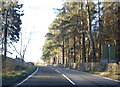
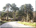
Damhead
Raemoir House estate on the right of the A980.
Image: © Stanley Howe
Taken: 27 Nov 2008
0.01 miles
2
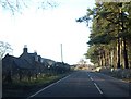
Watchmaker's Cottage
Damhead by Raemoir.
Image: © Stanley Howe
Taken: 27 Nov 2008
0.02 miles
3
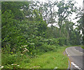
Winding road near Torphins
This view of the road bend is through a deciduous native woodland.
Image: © C Michael Hogan
Taken: 4 Aug 2009
0.13 miles
4
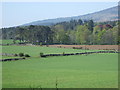
Mill Cottages and Burnside Belts
View towards the Raemoir junction from the corner of Hawthorn Wood. The rise of Hill of Fare is in the right rear.
Image: © Stanley Howe
Taken: 3 May 2007
0.15 miles
5
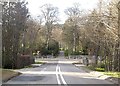
Approach to the Burnside Belts
And the A980/B977 T-junction.
Image: © Stanley Howe
Taken: 5 May 2013
0.16 miles
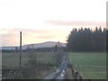
6
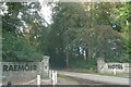
Main (south) entrance to Raemoir House Hotel.
Image: © Stanley Howe
Taken: 12 Oct 2006
0.16 miles
7
Approach to a bridge over the Bo Burn
On the A980 from Banchory; with an entrance to Raemoir House Hotel ahead at the junction of the A980 and the B977.
Image: © Stanley Howe
Taken: 5 May 2013
0.16 miles
8
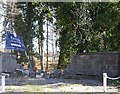
Raemoir Hotel: Special opening!
Aftermath of a frosty morning some weeks earlier.
Image: © Stanley Howe
Taken: 11 Apr 2009
0.16 miles
9
Approach to Balwearie
From the north, off the A980. Balwearie Wood to the right; Scolty Hill in background.
Image: © Stanley Howe
Taken: 9 Jan 2007
0.20 miles
10
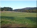
Raemoir
Mill Wood on left; Hill of Fare on right. Seen across grass field from minor road near Hawthorn Wood.
Image: © Stanley Howe
Taken: 6 Oct 2018
0.21 miles