IMAGES TAKEN NEAR TO
Wesley Road, WHITBY, YO22 4RW

Introduction

This page details the photographs taken nearby to Wesley Road, YO22 4RW by members of the Geograph project.

The Geograph project started in 2005 with the aim of publishing, organising and preserving representative images for every square kilometre of Great Britain, Ireland and the Isle of Man.

There are currently over 7.5m images from over14,400 individuals and you can help contribute to the project by visiting https://www.geograph.org.uk

Image Map


Images are licensed for reuse under creativecommons.org/licenses/by-sa/2.0
Notes
  • Clicking on the map will re-center to the selected point.
  • The higher the marker number, the further away the image location is from the centre of the postcode.

Image Listing (419 Images Found)

Images are licensed for reuse under creativecommons.org/licenses/by-sa/2.0
  • ...
Image
Details
Distance
1
Robin Hood's Bay Methodist Church
The Methodist Church in the village of Robin Hood's Bay, on the Yorkshire coast. The church sits astride two Ordnance Survey squares. Most of the building is in square NZ9505, however the section furthest to the left including the short tower and spire is in the adjacent square, NZ9405.
Image: © Malc McDonald Taken: 28 Apr 2021
0.02 miles
2
Methodist Chapel, Robin Hoods Bay
Image: © Humphrey Bolton Taken: 3 Feb 2014
0.02 miles
3
Thorpe Lane
Image: © N Chadwick Taken: 4 Jun 2010
0.02 miles
4
Buildings at Robin Hood's Bay
On Station Road, the B1447. On the right is North Ings, an C18 former farmhouse. Beyond is Jays House - see Image
Image: © Derek Harper Taken: 1 Jan 2013
0.02 miles
5
Methodist Church, Robin Hood's Bay
This view of the church is from the old Railway Station (now a series of workshops).
Image: © Peter Church Taken: 31 Mar 2008
0.03 miles
6
Thorpe Lane, Robin Hood's Bay
The bus route through the village.
Image: © Gerald England Taken: 2 Aug 2021
0.03 miles
7
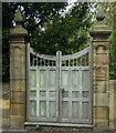
Old gateway on Station Road, Robin Hood's Bay
Image: © JThomas Taken: 13 May 2016
0.04 miles
8
Jays House and attached outbuildings, Station Road
A grade II listed 2 storey house, attached to stable and coach-house range of C18 origin. (Originally Manor House, circa 1320). LBS Number: 327841
Image: © Mike Kirby Taken: 7 Jul 2010
0.04 miles
9
Robin Hood's Bay
Oddly-placed village that slopes down to the sea.
Image: © Michael Ball Taken: 24 Aug 2009
0.04 miles
10
Rooftops in Baytown from the Old Schoolhouse.
The pantiles give the dominant colour to the buildings of Robin Hood's Bay. In the centre of the photograph is the 1 in 3 Hill "New Road". At the bottom of the grassy slope immediately in front of the photographer is King's Beck. The beck is culverted beside New Road for the last 100 metres (approx) and reaches the sea beside the Bay Hotel.
Image: © Peter Church Taken: 3 Apr 2005
0.04 miles
  • ...