Rooftops in Baytown from the Old Schoolhouse.
Introduction
The photograph on this page of Rooftops in Baytown from the Old Schoolhouse. by Peter Church as part of the Geograph project.
The Geograph project started in 2005 with the aim of publishing, organising and preserving representative images for every square kilometre of Great Britain, Ireland and the Isle of Man.

There are currently over 7.5m images from over 14,400 individuals and you can help contribute to the project by visiting https://www.geograph.org.uk
Rooftops in Baytown from the Old Schoolhouse.
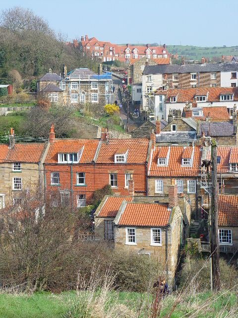
Image: © Peter Church Taken: 3 Apr 2005
The pantiles give the dominant colour to the buildings of Robin Hood's Bay. In the centre of the photograph is the 1 in 3 Hill "New Road". At the bottom of the grassy slope immediately in front of the photographer is King's Beck. The beck is culverted beside New Road for the last 100 metres (approx) and reaches the sea beside the Bay Hotel.
Images are licensed for reuse under creativecommons.org/licenses/by-sa/2.0
Image Location
Latitude
54.434958
Longitude
-0.53598