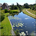
IMAGES TAKEN NEAR TO
Lindon Close, WALSALL, WS8 6FD

Introduction

This page details the photographs taken nearby to Lindon Close, WS8 6FD by members of the Geograph project.

The Geograph project started in 2005 with the aim of publishing, organising and preserving representative images for every square kilometre of Great Britain, Ireland and the Isle of Man.

There are currently over 7.5m images from over14,400 individuals and you can help contribute to the project by visiting https://www.geograph.org.uk

Image Map


Images are licensed for reuse under creativecommons.org/licenses/by-sa/2.0
Notes
  • Clicking on the map will re-center to the selected point.
  • The higher the marker number, the further away the image location is from the centre of the postcode.

Image Listing (40 Images Found)

Images are licensed for reuse under creativecommons.org/licenses/by-sa/2.0
  • ...
Image
Details
Distance
1
Sculpture, Catshill Junction
Image: © Geoff Pick Taken: 13 Jul 2008
0.03 miles
2
Catshill Junction view - Brownhills, Staffordshire
A view of Catshill Junction, looking north-north-east from Catshill Junction Bridge, where the Daw End Branch Canal at its northern end joins the Wyrley and Essington Canal, locally known for its winding course as the Curly Wyrley. The Daw End Branch Canal opened in 1803 to transport coal and limestone from local workings to the Black Country furnaces. It runs from Catshill Junction Image to Longwood Junction Image a distance of 5.25 miles. It being a contour canal, there are no locks along its length. The placename Daw End is locally pronounced as Doe End. The Wyrley and Essington Canal was constructed in the early 1790s from Wolverhampton, originally to Wyrley Bank and Essington collieries and with a later extension to Huddlesford Junction, near Lichfield. The engineer was William Pitt and being a contour canal there were no locks along its length. The Canal has been affected by subsidence from the very collieries it was built to serve and some parts are currently derelict. Source: www.canalrivertrust.org.uk. Time taken 1.12 pm BST (British Summer Time). Image]
Image: © Martin Richard Phelan Taken: 5 Jun 2013
0.03 miles
3
Catshill Junction
At Catshill Junction the Daw End Branch heads south from the Wyrley & Essington Canal main line through this bridge. It is not in fact a branch any more, continuing as the Rushall Canal to meet the Tame Valley Canal at Rushall Junction.
Image: © Stephen McKay Taken: 6 Apr 2016
0.04 miles
4
Junction Bridge, Clayhanger Junction
Carrying the Wyrley & Essington canal towpath over the Daw End Branch.
Image: © Christine Johnstone Taken: 6 May 2018
0.04 miles
5
Catshill Junction Bridge - Brownhills, Staffordshire
A party of ramblers crosses Catshill Junction Bridge on this June day in 2013. The bridge crosses the Daw End Branch Canal immediately before Catshill Junction, where this canal at its northern end joins the Wyrley and Essington Canal, locally known for its winding course as the Curly Wyrley. The Daw End Branch Canal opened in 1803 to transport coal and limestone from local workings to the Black Country furnaces. It runs from Catshill Junction Image to Longwood Junction Image a distance of 5.25 miles. It being a contour canal, there are no locks along its length. The placename Daw End is locally pronounced as Doe End. The Wyrley and Essington Canal was constructed in the early 1790s from Wolverhampton, originally to Wyrley Bank and Essington collieries and with a later extension to Huddlesford Junction, near Lichfield. The engineer was William Pitt and being a contour canal there were no locks along its length. The Canal has been affected by subsidence from the very collieries it was built to serve and some parts are currently derelict. Source: www.canalrivertrust.org.uk. Time taken 1.12 pm BST (British Summer Time). Image]
Image: © Martin Richard Phelan Taken: 5 Jun 2013
0.04 miles
6
Start of the Daw End Branch of the Wyrley and Essington Canal, Brownhills
Image: © Robin Stott Taken: 6 Aug 2016
0.06 miles
7
Signpost, Catshill Junction
Image: © Geoff Pick Taken: 12 Jul 2008
0.06 miles
8
Houses in Chandlers Keep, Brownhills
A small development, bounded on two sides by the Wyrley & Essington Canal and its Daw End Branch [seen here].
Image: © Christine Johnstone Taken: 6 May 2018
0.07 miles
9
Catshill Junction Bridge
The Anglesey Branch is to the right after the bridge, leading to Chasewater.
Image: © Geoff Pick Taken: 13 Jul 2008
0.08 miles
10
Container freight on the High Street, A452, Brownhills
In the distance the A452 becomes the Chester Road again, heading for Sutton Coldfield. Seen from the junction with Ogley Road.
Image: © Robin Stott Taken: 6 Aug 2016
0.09 miles
  • ...