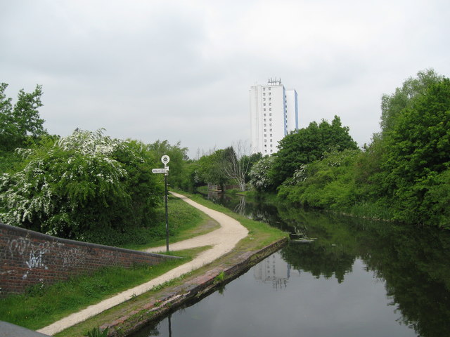
Catshill Junction view - Brownhills, Staffordshire
Introduction
The photograph on this page of Catshill Junction view - Brownhills, Staffordshire by Martin Richard Phelan as part of the Geograph project.
The Geograph project started in 2005 with the aim of publishing, organising and preserving representative images for every square kilometre of Great Britain, Ireland and the Isle of Man.
There are currently over 7.5m images from over 14,400 individuals and you can help contribute to the project by visiting https://www.geograph.org.uk

Image: © Martin Richard Phelan Taken: 5 Jun 2013
A view of Catshill Junction, looking north-north-east from Catshill Junction Bridge, where the Daw End Branch Canal at its northern end joins the Wyrley and Essington Canal, locally known for its winding course as the Curly Wyrley. The Daw End Branch Canal opened in 1803 to transport coal and limestone from local workings to the Black Country furnaces. It runs from Catshill Junction Image to Longwood Junction Image a distance of 5.25 miles. It being a contour canal, there are no locks along its length. The placename Daw End is locally pronounced as Doe End. The Wyrley and Essington Canal was constructed in the early 1790s from Wolverhampton, originally to Wyrley Bank and Essington collieries and with a later extension to Huddlesford Junction, near Lichfield. The engineer was William Pitt and being a contour canal there were no locks along its length. The Canal has been affected by subsidence from the very collieries it was built to serve and some parts are currently derelict. Source: www.canalrivertrust.org.uk. Time taken 1.12 pm BST (British Summer Time). Image]

