
IMAGES TAKEN NEAR TO
Coppice Way, DROITWICH, WR9 9JB
Introduction
This page details the photographs taken nearby to Coppice Way, WR9 9JB by members of the Geograph project.
The Geograph project started in 2005 with the aim of publishing, organising and preserving representative images for every square kilometre of Great Britain, Ireland and the Isle of Man.

There are currently over 7.5m images from over14,400 individuals and you can help contribute to the project by visiting https://www.geograph.org.uk
Image Map
Images are licensed for reuse under creativecommons.org/licenses/by-sa/2.0
Notes
- Clicking on the map will re-center to the selected point.
- The higher the marker number, the further away the image location is from the centre of the postcode.
Image Listing (34 Images Found)
Images are licensed for reuse under creativecommons.org/licenses/by-sa/2.0
Image
Details
Distance
1
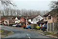
Coppice Way, Droitwich Spa
A housing development on the western edge of Droitwich Spa.
Image: © Mary and Angus Hogg
Taken: 6 Dec 2012
0.05 miles
2

Start of footpath, Westwood Road Open Space, Westlands, Droitwich Spa, Worcs
At the north western end of the open space is the start of a footpath. However at the time the photograph was taken it was not feasible to explore further as the path was blocked by fallen trees.
Image: © P L Chadwick
Taken: 24 Apr 2021
0.10 miles
3
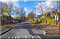
Farmers Way looking west, Westlands, Droitwich Spa
Farmers Way connects the main road through the Westlands estate, Westwood Road, with the estate's centre. However there is not a great deal to get excited about at the centre, as the number of facilities it offers are surprisingly limited for an estate of this size. It does however have two fish & chip shops, both of which were closed despite it being a Saturday lunchtime. The only places open at that time appeared to be the local pub, and the Costcutters supermarket.
The estate originally housed many people who worked for the former British Leyland, later Rover Group etc, motor car works at Longbridge, Birmingham. Access to this was relatively easy by using the nearby A38 road. The declining factory finally closed in 2005. The estate was originally called Boycott after a local land-owning family but later was renamed Westlands.
Image: © P L Chadwick
Taken: 3 Nov 2012
0.16 miles
4
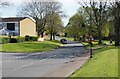
Westwood Road, Westlands, Droitwich Spa, Worcs
Westwood Road is the main road serving the Westlands housing estate. The road coming in from the left is Farriers Way.
Image: © P L Chadwick
Taken: 24 Apr 2021
0.16 miles
5
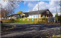
WANDS Children's Centre, Farmers Way, Westlands, Droitwich Spa
WANDS Children's Centre was opened in May 2003. It is run by Worcestershire County Council, who run most of their local groups at the Children's Centre, which is based on the campus of Westlands First School. The Centre provides support to parents as well as children.
Image: © P L Chadwick
Taken: 3 Nov 2012
0.17 miles
6
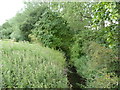
Elmbridge Brook looking downstream
The stream forms the parish boundary between Droitwich Spa and Hampton Lovett.
The Westlands housing estate extends almost to the boundary and this taken from a footbridge near Paddock Close. Image faces upstream.
Image: © Jeff Gogarty
Taken: 10 Jul 2015
0.17 miles
7
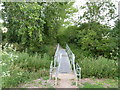
Footbridge across Elmbridge Brook
The bridge is designed so cyclists cannot ride across.
The stream forms the parish boundary between Droitwich Spa and Hampton Lovett and a footpath leads from Westlands housing estate to Stonebridge Cross Business Park.
Image: © Jeff Gogarty
Taken: 10 Jul 2015
0.18 miles
8
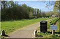
Footpath in Westwood Road Open Space, Westlands, Droitwich Spa, Worcs
The open space runs adjacent to Westwood Road, and contains some facilities for children as well as an area that seems to be planted with ornamental trees. Behind the camera position is a bus stop and shelter. By the litter bin is a sign with information about the open space.
Image: © P L Chadwick
Taken: 24 Apr 2021
0.19 miles
9
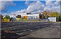
Westlands First School, Farmers Way, Westlands, Droitwich Spa
Westlands First School is a local authority (Worcestershire County Council) maintained community school. It currently has over 250 pupils and caters for the 3 to 9 years age range. The school opened in 1969. At that time, a large number of the residents of Westlands, which was then known as the Boycott Estate (after a local landowner), were working at the former Longbridge car plant in Birmingham.
Image: © P L Chadwick
Taken: 3 Nov 2012
0.19 miles
10
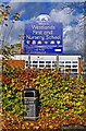
School sign and a litter bin, Farmers Way, Westlands, Droitwich Spa
Westlands First School:- Image
Image: © P L Chadwick
Taken: 3 Nov 2012
0.19 miles