IMAGES TAKEN NEAR TO
East Lane, WATFORD, WD25 0LJ
Introduction
This page details the photographs taken nearby to East Lane, WD25 0LJ by members of the Geograph project.
The Geograph project started in 2005 with the aim of publishing, organising and preserving representative images for every square kilometre of Great Britain, Ireland and the Isle of Man.

There are currently over 7.5m images from over14,400 individuals and you can help contribute to the project by visiting https://www.geograph.org.uk
Image Map
Images are licensed for reuse under creativecommons.org/licenses/by-sa/2.0
Notes
- Clicking on the map will re-center to the selected point.
- The higher the marker number, the further away the image location is from the centre of the postcode.
Image Listing (16 Images Found)
Images are licensed for reuse under creativecommons.org/licenses/by-sa/2.0
Image
Details
Distance
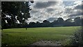
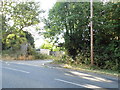
2
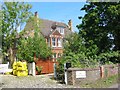
Coles Farm Woodside Road Waterdale
This farm house appears to have been gentrified
Image: © Jack Hill
Taken: 15 Aug 2005
0.06 miles
3
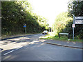
Woodside Road at the junction of High Elms Lane
Image: © David Howard
Taken: 19 Sep 2012
0.09 miles
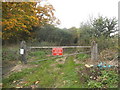
4
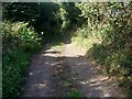
Bridleway over the M25 to Bedmond
Contrast this to http://www.geograph.org.uk/photo/392549 taken in April. By September the path is much more overgrown. I'll try to come back in winter-mud permitting!
Image: © Bikeboy
Taken: 9 Sep 2012
0.13 miles
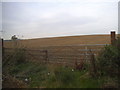
6

Waterdale: Bridleway to Bedmond
This bridleway also marks the boundary between the Three Rivers District Council area to the left, and St Albans District Council to the right.
Image: © Nigel Cox
Taken: 6 Apr 2007
0.14 miles
9
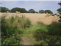
Harvested fields near M25 M1 junction
Hard to believe it is so close to the M25 except for the noise.
Image: © Bikeboy
Taken: 1 Sep 2012
0.17 miles
10
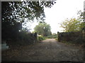
Public footpath by Home Farm on Woodside Road
Image: © David Howard
Taken: 19 Sep 2012
0.18 miles