IMAGES TAKEN NEAR TO
Muirfield, LONDON, W3 7NR
Introduction
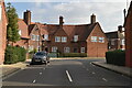
This page details the photographs taken nearby to Muirfield, W3 7NR by members of the Geograph project.
The Geograph project started in 2005 with the aim of publishing, organising and preserving representative images for every square kilometre of Great Britain, Ireland and the Isle of Man.

There are currently over 7.5m images from over14,400 individuals and you can help contribute to the project by visiting https://www.geograph.org.uk
Image Map
Images are licensed for reuse under creativecommons.org/licenses/by-sa/2.0
Notes
- Clicking on the map will re-center to the selected point.
- The higher the marker number, the further away the image location is from the centre of the postcode.
Image Listing (105 Images Found)
Images are licensed for reuse under creativecommons.org/licenses/by-sa/2.0
Image
Details
Distance
1
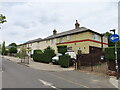
East Acton: Fitzneal Street, W12
Housing in the Old Oak Common Conservation Area.
(Described here as being in East Acton, but also referred to as being in both the Shepherds Bush and White City areas)
Image: © Nigel Cox
Taken: 9 Feb 2007
0.05 miles
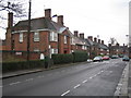
2
Old Oak Common Lane, East Acton
This grid-square lies just to the south of the railway complexes at Old Oak Common and Willesden Junction, and contributions for this grid-square seem largely concerned with railways - even though much of the area is residential.
The red-brick houses along Old Oak Common Lane and Fitzneal Street (nearby) must surely have been built as part of the local authority 'Homes fit for Heroes' campaign of the 1920's and '30's. So not only was this area open countryside when the railways first arrived, but it remained so for a good many years after the building of Wormwood Scrubs prison and Hammersmith Hospital (in the next grid-square east).
Shot taken looking south from near the corner of Fitzneal Street - on a Saturday evening.
Image: © Stefan Czapski
Taken: 10 Aug 2013
0.06 miles
3
Houses on Brassie Avenue, East Acton
Streets on the Golf Links estate have golf-related names, a brassie is a number 2 wood.
Image: © David Hawgood
Taken: 29 Aug 2022
0.08 miles
4
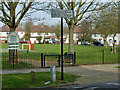
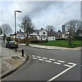
The Green, East Acton
A small patch of green in a housing estate.
Image: © Robin Webster
Taken: 27 Mar 2011
0.08 miles
5
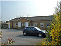
Old Oak Methodist Church
On The Fairway, W3.
Image: © Robin Webster
Taken: 27 Mar 2011
0.08 miles
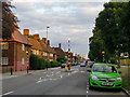
6
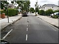
Street View in East Acton
A view of Brassie Avenue in East Acton, North of the busy Westway A40 in London.
Image: © John P Reeves
Taken: 13 Jul 2021
0.09 miles
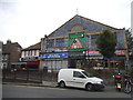
7
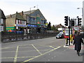
Eye Spy Opticians and other stores
Across Old Oak Common Lane at the end of Du Cane Road.
Image: © Peter Whatley
Taken: 6 Apr 2010
0.09 miles
8
East Acton - Golf Links housing estate
Brassie Avenue and St Andrew's Road crossroad.
The estate was built in the 1920's on a golf course.
Image: © James Emmans
Taken: 12 Mar 2023
0.10 miles