IMAGES TAKEN NEAR TO
Victoria Grove Mews, LONDON, W2 4LN

Introduction

This page details the photographs taken nearby to Victoria Grove Mews, W2 4LN by members of the Geograph project.

The Geograph project started in 2005 with the aim of publishing, organising and preserving representative images for every square kilometre of Great Britain, Ireland and the Isle of Man.

There are currently over 7.5m images from over14,400 individuals and you can help contribute to the project by visiting https://www.geograph.org.uk

Image Map


Images are licensed for reuse under creativecommons.org/licenses/by-sa/2.0
Notes
  • Clicking on the map will re-center to the selected point.
  • The higher the marker number, the further away the image location is from the centre of the postcode.

Image Listing (422 Images Found)

Images are licensed for reuse under creativecommons.org/licenses/by-sa/2.0
  • ...
Image
Details
Distance
1
Queensway tube station
Image: © Rob Purvis Taken: 16 Mar 2007
0.01 miles
2
Palace Court, W2
Image: © Danny P Robinson Taken: 29 Apr 2007
0.02 miles
3
The Champion, Baywater
Image: © Chris Whippet Taken: 30 Apr 2009
0.02 miles
4
Kensington, The Champion
Pub at the corner of Wellington Terrace and Ossington Street; bar left, eating and drinking areas right; old floor tiles, open fireplaces, some exposed brickwork, dark colours, background music, basement and garden. Cask ales on offer at my visit: Adnams Broadside, Itchen Valley Junga, Nicholson's Pale, Windsor & Eton Knight of the Garter, Wychwood Hobgoblin. For some customer comments, see http://www.beerintheevening.com/pubs/s/21/2119/Champion/Notting_Hill
Image: © Mike Faherty Taken: 27 Oct 2012
0.02 miles
5
Ossington Street, London W2
Viewed from the Bayswater Road/Notting Hill Gate end looking towards Moscow Road. On the left is the turning into Victoria Grove Mews.
Image: © Jaggery Taken: 13 May 2012
0.02 miles
6
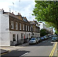
Ossington Street
Image: © Oast House Archive Taken: 14 Aug 2014
0.03 miles
7
View along Notting Hill Gate
Looking north-northeast.
Image: © Robert Lamb Taken: 14 Sep 2010
0.03 miles
8
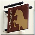
The Champion sign
Image: © Oast House Archive Taken: 14 Aug 2014
0.03 miles
9
Old Boundary Marker by the A40, Bayswater Road, Paddington parish
Parish Boundary Marker by the A40, in parish of Paddington, Bayswater and Knightsbridge (City of Westminster District) W2, at the corner of Ossington Street, in pavement by No 5. Inscription reads:- NO. 16. M.B.P. 1900. IN THE CENTRE OF THE TWO ROADS OPPOSITE IS THE BOUNDARY OF PADDINGTON Surveyed Milestone Society National ID: MX_PADDB23pb
Image: © Milestone Society Taken: Unknown
0.03 miles
10
Clanricarde Gardens
Image: © N Chadwick Taken: 9 Oct 2021
0.03 miles
  • ...