Old Boundary Marker by the A40, Bayswater Road, Paddington parish
Introduction
The photograph on this page of Old Boundary Marker by the A40, Bayswater Road, Paddington parish by Milestone Society as part of the Geograph project.
The Geograph project started in 2005 with the aim of publishing, organising and preserving representative images for every square kilometre of Great Britain, Ireland and the Isle of Man.

There are currently over 7.5m images from over 14,400 individuals and you can help contribute to the project by visiting https://www.geograph.org.uk
Old Boundary Marker by the A40, Bayswater Road, Paddington parish
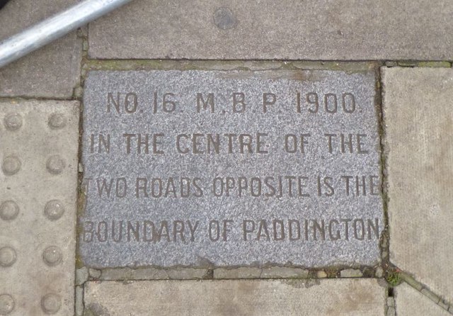
Image: © Milestone Society Taken: Unknown
Parish Boundary Marker by the A40, in parish of Paddington, Bayswater and Knightsbridge (City of Westminster District) W2, at the corner of Ossington Street, in pavement by No 5. Inscription reads:- NO. 16. M.B.P. 1900. IN THE CENTRE OF THE TWO ROADS OPPOSITE IS THE BOUNDARY OF PADDINGTON Surveyed Milestone Society National ID: MX_PADDB23pb
Images are licensed for reuse under creativecommons.org/licenses/by-sa/2.0
Image Location
Latitude
51.509955
Longitude
-0.192137