
IMAGES TAKEN NEAR TO
Ashwell, TEIGNMOUTH, TQ14 9TH
Introduction
This page details the photographs taken nearby to TQ14 9TH by members of the Geograph project.
The Geograph project started in 2005 with the aim of publishing, organising and preserving representative images for every square kilometre of Great Britain, Ireland and the Isle of Man.

There are currently over 7.5m images from over14,400 individuals and you can help contribute to the project by visiting https://www.geograph.org.uk
Image Map
Images are licensed for reuse under creativecommons.org/licenses/by-sa/2.0
Notes
- Clicking on the map will re-center to the selected point.
- The higher the marker number, the further away the image location is from the centre of the postcode.
Image Listing (41 Images Found)
Images are licensed for reuse under creativecommons.org/licenses/by-sa/2.0
Image
Details
Distance
1
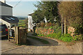
Ashwell
Bishopsteignton footpath 1 follows this track through the small hamlet.
Image: © Derek Harper
Taken: 22 Mar 2022
0.02 miles
2
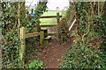
Stile, Ashwell
Bishopsteignton footpath 1 heads off from the spot where Image was taken, over a stile into the field shown in Image
Image: © Derek Harper
Taken: 20 Jan 2019
0.03 miles
3
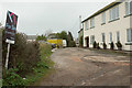
Houses, Ashwell
A hamlet of six properties along a cul-de-sac followed by Bishopsteignton footpath 1.
Image: © Derek Harper
Taken: 20 Jan 2019
0.03 miles
5
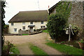
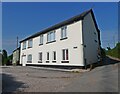
Ashwell House
"An attractive traditional house with an unspoiled exterior" https://historicengland.org.uk/listing/the-list/list-entry/1097790 seen from Bishopsteignton footpath 1.
Image: © Derek Harper
Taken: 20 Jan 2019
0.05 miles
6
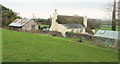
Ashwell House
From Bishopsteignton footpath 1, which reaches a stile in the corner of the field on the left. See also Image
Image: © Derek Harper
Taken: 20 Jan 2019
0.05 miles
7
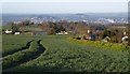
Field by Rowden Cross
Taken close to Image, which commands extensive views westwards. The tramlines are running parallel to the lane to Kingsteignton, on the right. The houses on the left are around Colway Cross, in Image The view beyond includes part of Newton Abbot.
Image: © Derek Harper
Taken: 9 Apr 2008
0.05 miles
8
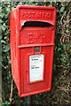
Postbox, Ashwell
The Elizabeth II postbox, also shown in Image], is number TQ14 36.
Image: © Derek Harper
Taken: 20 Jan 2019
0.05 miles
9
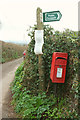
Sign and postbox, Ashwell
Indicating the start of Bishopsteignton footpath 1. The Elizabeth II postbox is number TQ14 36. The lane leads to Colway Cross.
Image: © Derek Harper
Taken: 20 Jan 2019
0.05 miles
10
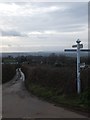
Rowden Cross
The road to Kingsteignton and the countryside around Newton Abbot
Image: © David Smith
Taken: 5 Feb 2012
0.06 miles