
IMAGES TAKEN NEAR TO
Old Totnes Road, NEWTON ABBOT, TQ13 7EE
Introduction
This page details the photographs taken nearby to Old Totnes Road, TQ13 7EE by members of the Geograph project.
The Geograph project started in 2005 with the aim of publishing, organising and preserving representative images for every square kilometre of Great Britain, Ireland and the Isle of Man.

There are currently over 7.5m images from over14,400 individuals and you can help contribute to the project by visiting https://www.geograph.org.uk
Image Map
Images are licensed for reuse under creativecommons.org/licenses/by-sa/2.0
Notes
- Clicking on the map will re-center to the selected point.
- The higher the marker number, the further away the image location is from the centre of the postcode.
Image Listing (194 Images Found)
Images are licensed for reuse under creativecommons.org/licenses/by-sa/2.0
Image
Details
Distance
1
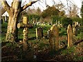
Graveyard, Ashburton (2)
Graves near the southern edge of Image, seen from the Church Path, which is followed by Ashburton Footpath 8.
Image: © Derek Harper
Taken: 12 Dec 2008
0.08 miles
3
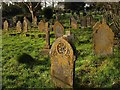
Graveyard, Ashburton (3)
Image: © Derek Harper
Taken: 12 Dec 2008
0.09 miles
4
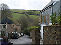
Church Path, Ashburton
Here the path shown in Image is a stretch of road connected to the Old Totnes Road via Stonepark, to the right beyond the new house. Past the old auction rooms on the left, the path drops to cross River Ashburn and the former railway in quick succession to the scene shown in Image
On the far hill a field boundary climbs to meet Cabbage Hill, the lane to Landscove.
Image: © Derek Harper
Taken: 13 Dec 2008
0.09 miles
5
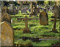
Graveyard, Ashburton
A view across graves from the Church Path. This is a large irregularly shaped graveyard extending some way south of St Andrew’s Church.
Image: © Derek Harper
Taken: 12 Dec 2008
0.09 miles
6
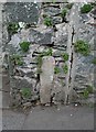
Old Bridge Marker by Old Totnes Road, Ashburton
Bridge Marker by the UC road, in parish of Ashburton (Teignbridge District), Old Totnes Road, near Gulwell Bridge, cemented in wall at foot of steps to "Westbury", Northwest side of road.
Surveyed
Milestone Society National ID: DV_ASTO01br
Image: © Alan Rosevear
Taken: 24 Feb 2012
0.10 miles
7
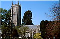
Ashburton, St Andrew's church
This church was entirely rebuilt in the 15th century, with its 92 ft tower.
Image: © Patrick GUEULLE
Taken: Unknown
0.10 miles
8
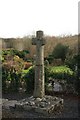
Cross at Saint Gudula's Well
A restored cross standing by the well (marked on OS 1:25000 map). See http://www.legendarydartmoor.co.uk/gudula_well.htm
Image: © Guy Wareham
Taken: 1 Feb 2010
0.11 miles
9
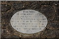
Saint Gudula's well
A plaque mounted on the wall above the well. See http://www.legendarydartmoor.co.uk/gudula_well.htm
Image: © Guy Wareham
Taken: 1 Feb 2010
0.11 miles
10

Graveyard of St Andrew's church, Ashburton
I was struck by the simplicity of this simple grave marked by just a wooden cross. It bore the name of what I presumed was a young girl. Her loved ones had covered her plot with beautiful white begonias in wonderful full bloom at the time of my visit. It made me feel quite sad.
Image: © Derek Voller
Taken: 16 Jun 2014
0.12 miles