Saint Gudula's well
Introduction
The photograph on this page of Saint Gudula's well by Guy Wareham as part of the Geograph project.
The Geograph project started in 2005 with the aim of publishing, organising and preserving representative images for every square kilometre of Great Britain, Ireland and the Isle of Man.

There are currently over 7.5m images from over 14,400 individuals and you can help contribute to the project by visiting https://www.geograph.org.uk
Saint Gudula's well
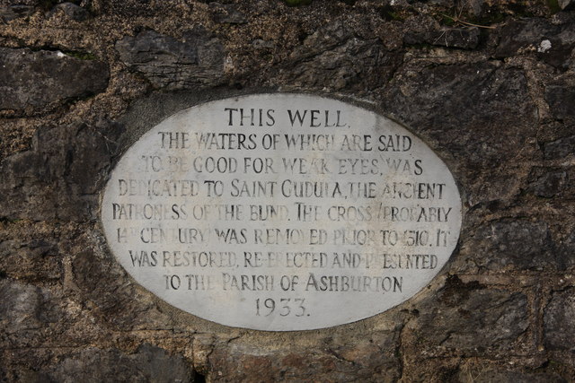
Image: © Guy Wareham Taken: 1 Feb 2010
A plaque mounted on the wall above the well. See http://www.legendarydartmoor.co.uk/gudula_well.htm
Images are licensed for reuse under creativecommons.org/licenses/by-sa/2.0
Image Location
Latitude
50.510823
Longitude
-3.758784