
IMAGES TAKEN NEAR TO
Florence Close, TELFORD, TF1 2FN
Introduction
This page details the photographs taken nearby to Florence Close, TF1 2FN by members of the Geograph project.
The Geograph project started in 2005 with the aim of publishing, organising and preserving representative images for every square kilometre of Great Britain, Ireland and the Isle of Man.

There are currently over 7.5m images from over14,400 individuals and you can help contribute to the project by visiting https://www.geograph.org.uk
Image Map
Images are licensed for reuse under creativecommons.org/licenses/by-sa/2.0
Notes
- Clicking on the map will re-center to the selected point.
- The higher the marker number, the further away the image location is from the centre of the postcode.
Image Listing (75 Images Found)
Images are licensed for reuse under creativecommons.org/licenses/by-sa/2.0
Image
Details
Distance
2
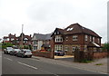
Holyhead Road, Wellington
Looking north east on the B5061.
Image: © JThomas
Taken: 18 May 2019
0.10 miles
3
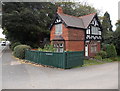
Former Sunnycroft Lodge, Wellington
The Holyhead Road house used to be the lodge at the entrance to Sunnycroft, an Edwardian gentleman's suburban villa. Sunnycroft is now a National Trust property.
Image: © Jaggery
Taken: 10 Oct 2013
0.11 miles
4
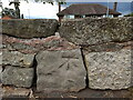
Cancelled benchmark on N side of the former A5
The 1882 map, published shortly after the 1st Primary Levelling of the country in the period between 1840-1860, shows several benchmarks along this stretch of Watling Street, variously at about 371ft, 373ft, 384ft and 380ft above Liverpool datum. This mark looks like it was one of those; from its location it's probably the 373ft or 384ft mark. However, it appears that the low wall bounding the north side of the road has been rebuilt at some stage, the stone's been moved and reset into the wall in a non-original location, and the mark's been cancelled as a result.
Image: © Richard Law
Taken: 24 Sep 2022
0.11 miles
5
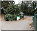
Welcome to Sunnycroft, Wellington
The welcome board is at the Holyhead Road entrance to Sunnycroft, now a National Trust site. Sunnycroft http://www.geograph.org.uk/photo/2513733 is a substantial red-brick villa, typical of the many thousands that were built for the prosperous middle classes in the late Victorian period. Sunnycroft is one of the very few villas to have survived with largely unaltered contents and decorations.
Image: © Jaggery
Taken: 10 Oct 2013
0.11 miles
6
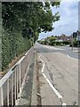
Watling Street, Wellington
The route of the old A5 through Wellington, before the M54 took all the through traffic away. As the name suggests, also the old Roman road out of Viroconium. Now a much quieter residential area.
Image: © Andrew Shannon
Taken: 10 Sep 2024
0.12 miles
7
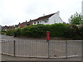
Houses on Holyhead Road, Wellington
Showing position of Postbox No. TF1 5.
See Image] for postbox.
Image: © JThomas
Taken: 18 May 2019
0.13 miles
8
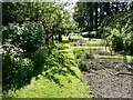
Part of the gardens at Sunnycroft, Wellington
Allotments in fact. Local residents tend their own patches. Most common veg and soft fruit can be seen here. A lovely space. Great to explore as you familiarise yourself with Sunnycroft.
Image: © Jeremy Bolwell
Taken: 4 Jun 2023
0.13 miles
9
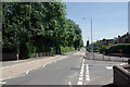
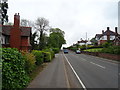
Holyhead Road, Wellington
The name gives a clue that this was once a more important road than it is now. Originally part of Roman Watling Street (note the dead straight alignment), it became the A5 in modern times. Nowadays, however, through traffic is directed onto the M54, which runs a short distance to the south, leaving Holyhead Road, with its new designation as the B5061, with hardly any traffic (at least in this view). Golf Links Lane leads off to the right.
Image: © Stephen McKay
Taken: 15 Jun 2021
0.14 miles
10

Elizabeth II postbox on Holyhead Road, Wellington
Postbox No. TF1 5.
See Image] for context.
Image: © JThomas
Taken: 18 May 2019
0.14 miles