Cancelled benchmark on N side of the former A5
Introduction
The photograph on this page of Cancelled benchmark on N side of the former A5 by Richard Law as part of the Geograph project.
The Geograph project started in 2005 with the aim of publishing, organising and preserving representative images for every square kilometre of Great Britain, Ireland and the Isle of Man.

There are currently over 7.5m images from over 14,400 individuals and you can help contribute to the project by visiting https://www.geograph.org.uk
Cancelled benchmark on N side of the former A5
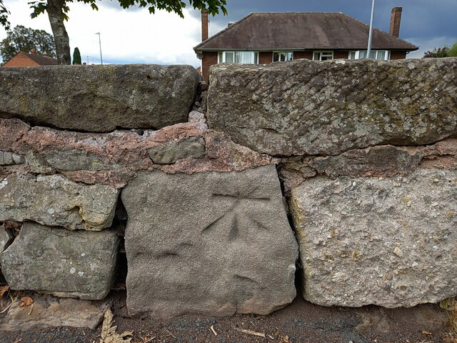
Image: © Richard Law Taken: 24 Sep 2022
The 1882 map, published shortly after the 1st Primary Levelling of the country in the period between 1840-1860, shows several benchmarks along this stretch of Watling Street, variously at about 371ft, 373ft, 384ft and 380ft above Liverpool datum. This mark looks like it was one of those; from its location it's probably the 373ft or 384ft mark. However, it appears that the low wall bounding the north side of the road has been rebuilt at some stage, the stone's been moved and reset into the wall in a non-original location, and the mark's been cancelled as a result.
Images are licensed for reuse under creativecommons.org/licenses/by-sa/2.0
Image Location
Latitude
52.694936
Longitude
-2.513687