
IMAGES TAKEN NEAR TO
Wiseman Crescent, TELFORD, TF1 2FJ
Introduction
This page details the photographs taken nearby to Wiseman Crescent, TF1 2FJ by members of the Geograph project.
The Geograph project started in 2005 with the aim of publishing, organising and preserving representative images for every square kilometre of Great Britain, Ireland and the Isle of Man.

There are currently over 7.5m images from over14,400 individuals and you can help contribute to the project by visiting https://www.geograph.org.uk
Image Map
Images are licensed for reuse under creativecommons.org/licenses/by-sa/2.0
Notes
- Clicking on the map will re-center to the selected point.
- The higher the marker number, the further away the image location is from the centre of the postcode.
Image Listing (85 Images Found)
Images are licensed for reuse under creativecommons.org/licenses/by-sa/2.0
Image
Details
Distance
1

Golf Links Lane, Wellington
The suburban area of Wellington between the town centre and the Wrekin is leafy with generally sizeable private houses. This stretch of Golf Links Lane, which leads off Holyhead Road, gives the flavour.
Image: © Stephen McKay
Taken: 15 Jun 2021
0.05 miles
2
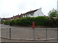
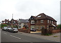
Houses on Holyhead Road, Wellington
Showing position of Postbox No. TF1 5.
See Image] for postbox.
Image: © JThomas
Taken: 18 May 2019
0.05 miles
3
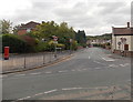
Golf Links Lane, Wellington
Viewed across the B5061 Holyhead Road. What caused the distortion in the metal strips near the red post box?
Image: © Jaggery
Taken: 10 Oct 2013
0.06 miles
4
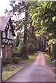
Driveway to Sunnycroft, Wellington
The driveway passes through an avenue of pine trees. A lodge guards the gateway.
Image: © Humphrey Bolton
Taken: 19 Jun 2000
0.06 miles
5
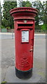
Elizabeth II postbox on Holyhead Road, Wellington
Postbox No. TF1 5.
See Image] for context.
Image: © JThomas
Taken: 18 May 2019
0.07 miles
6
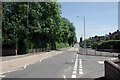
Holyhead Road, Wellington
The name gives a clue that this was once a more important road than it is now. Originally part of Roman Watling Street (note the dead straight alignment), it became the A5 in modern times. Nowadays, however, through traffic is directed onto the M54, which runs a short distance to the south, leaving Holyhead Road, with its new designation as the B5061, with hardly any traffic (at least in this view). Golf Links Lane leads off to the right.
Image: © Stephen McKay
Taken: 15 Jun 2021
0.07 miles
8
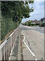
Watling Street, Wellington
The route of the old A5 through Wellington, before the M54 took all the through traffic away. As the name suggests, also the old Roman road out of Viroconium. Now a much quieter residential area.
Image: © Andrew Shannon
Taken: 10 Sep 2024
0.08 miles
9
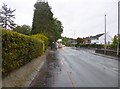
Wellington, Watling Street
Formerly A5, this section is now B5061, Holyhead Road, following the course of Roman Watling Street, from Hadrian's Wall to Dover.
Image: © Mike Faherty
Taken: 13 Oct 2014
0.09 miles
10
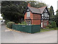
Former Sunnycroft Lodge, Wellington
The Holyhead Road house used to be the lodge at the entrance to Sunnycroft, an Edwardian gentleman's suburban villa. Sunnycroft is now a National Trust property.
Image: © Jaggery
Taken: 10 Oct 2013
0.10 miles