
IMAGES TAKEN NEAR TO
Queens Drive, NEWPORT, TF10 7EU
Introduction
This page details the photographs taken nearby to Queens Drive, TF10 7EU by members of the Geograph project.
The Geograph project started in 2005 with the aim of publishing, organising and preserving representative images for every square kilometre of Great Britain, Ireland and the Isle of Man.

There are currently over 7.5m images from over14,400 individuals and you can help contribute to the project by visiting https://www.geograph.org.uk
Image Map
Images are licensed for reuse under creativecommons.org/licenses/by-sa/2.0
Notes
- Clicking on the map will re-center to the selected point.
- The higher the marker number, the further away the image location is from the centre of the postcode.
Image Listing (12 Images Found)
Images are licensed for reuse under creativecommons.org/licenses/by-sa/2.0
Image
Details
Distance
1
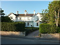
4 & 6 Station Road, Newport
A pair of Grade II listed https://britishlistedbuildings.co.uk/101188027-4-and-6-station-road-newport#.W6ePGdQrLGg 1840s villas.
Image: © Richard Law
Taken: 21 Aug 2018
0.06 miles
2
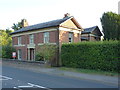
1 Station Road, Newport
Built around 1838 as the Station Master's house, and Grade II listed https://britishlistedbuildings.co.uk/101367315-1-station-road-newport#.W6ePvNQrLGg in 1978. The station lay at approximately SJ75011833, maybe 100 yards away to the ESE of here, on the former Wellington to Stafford branch of the Shropshire Union Railway and Canal Company line, later taken over by the London and North Western Railway, and which closed to passenger traffic in early September 1964.
Image: © Richard Law
Taken: 21 Aug 2018
0.09 miles
3
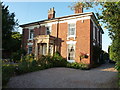
26 & 28 Station Road, Newport
From the outside apparently a single house, but actually divided into two; they were built around 1830, and were Grade II listed https://britishlistedbuildings.co.uk/101367316-26-and-28-station-road-newport#.W6eSltQrLGg in 1978.
Image: © Richard Law
Taken: 21 Aug 2018
0.14 miles
4
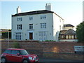
The Old Hall, Station Road, Newport
The Old Hall is late 18th century and was once the Manor House of Church Aston; it attracted a Grade II listing https://britishlistedbuildings.co.uk/101054340-old-hall-newport#.W6eT29QrLGg in 1978. It now appears to be the local doctors' surgery.
Image: © Richard Law
Taken: 21 Aug 2018
0.15 miles
5
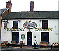
Railway Tavern, Newport
The nearest thing to a railway station that you will find in Newport. Taken in 2003.
Image: © Gordon Cragg
Taken: 13 Nov 2003
0.16 miles
6
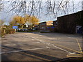
The Burton Borough school
Built in the mid 1950s, Burton Borough was for many years the town's Secondary Modern. It now has Specialist Arts College status, obtained in 2004, and caters for just over 1000 students.
http://www.burtonborough.wrekin.sch.uk/index.html
Image: © Richard Law
Taken: 4 Apr 2013
0.18 miles
7
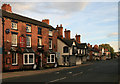
Upper Bar Newport
Looking from Newport High Street, passed The Pheasant Inn and The Shakespeare Inn, along Upper Bar.
Image: © David Rogers
Taken: 14 Aug 2008
0.19 miles
8
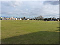
Newport Cricket Club
The cricket pitch belonging to Newport Cricket Club, with the buildings of the Burton Borough school beyond.
Image: © Richard Law
Taken: 4 Apr 2013
0.19 miles
9
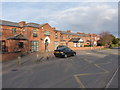
Audley House - the western end
This end of the buildings of Audley Court was the original Newport Poor Law Union Workhouse http://www.workhouses.org.uk/NewportSalop/ which was built in the mid 1850s, but is now converted to residential use. At the eastern end, the original workhouse was extended in 1908 with a 29-bed infirmary, which is partly visible in Image, and which is now part of residential facility operated by the Combat Stress charity for ex-forces personnel.
Image: © Richard Law
Taken: 4 Apr 2013
0.23 miles
10
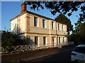
Audley Villa, Newport
Audley Villa dates from 1817, and was built originally as a grandstand to the Newport racecourse, then converted to a house around the turn of the 20th century. It attracted a Grade II listing (along with its railings & gates) https://britishlistedbuildings.co.uk/101367294-audley-villa-newport#.W6eWbNQrLGg in 1978.
Image: © Richard Law
Taken: 21 Aug 2018
0.23 miles