Audley House - the western end
Introduction
The photograph on this page of Audley House - the western end by Richard Law as part of the Geograph project.
The Geograph project started in 2005 with the aim of publishing, organising and preserving representative images for every square kilometre of Great Britain, Ireland and the Isle of Man.

There are currently over 7.5m images from over 14,400 individuals and you can help contribute to the project by visiting https://www.geograph.org.uk
Audley House - the western end
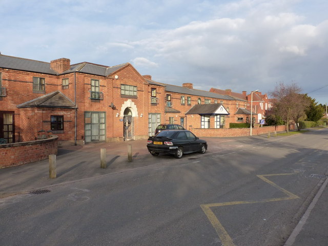
Image: © Richard Law Taken: 4 Apr 2013
This end of the buildings of Audley Court was the original Newport Poor Law Union Workhouse http://www.workhouses.org.uk/NewportSalop/ which was built in the mid 1850s, but is now converted to residential use. At the eastern end, the original workhouse was extended in 1908 with a 29-bed infirmary, which is partly visible in Image, and which is now part of residential facility operated by the Combat Stress charity for ex-forces personnel.
Images are licensed for reuse under creativecommons.org/licenses/by-sa/2.0
Image Location
Latitude
52.765954
Longitude
-2.368986