1
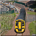
The Borders Railway at Galashiels Station
Driver training is still taking place prior to the opening of the new line on 6th September 2015. This train has pulled out of the Galashiels station and is heading for Tweedbank station.
Image: © Walter Baxter
Taken: 23 Aug 2015
0.02 miles
2
The Borders Railway at Galashiels Station
Driver training is still taking place prior to the opening of the new line on 6th September 2015. The building at the top left is the new transport interchange. This train has pulled out of the Galashiels station and is heading for Tweedbank station.
Image: © Walter Baxter
Taken: 23 Aug 2015
0.02 miles
3
The Union of South Africa steam special leaving Galashiels for Tweedbank
ScotRail are running a steam train on the new Borders Railway from Edinburgh to Tweedbank and back to Edinburgh on a Wednesday, Thursday and Sunday between 10th September and 18th October 2015. No 60009 Union of South Africa will haul vintage carriages on the journey. This steam locomotive was built at Doncaster in 1937 and is only one of six remaining LNER Class A4’s. These steam specials have created a lot of interest with the general public and many photographers have been at stations and viewing spots along the route.
Image: © Walter Baxter
Taken: 20 Sep 2015
0.02 miles
4
A steam special on the Borders Railway
This LMS Stanier Black Five locomotive 44871 hauling vintage carriages is leaving Galashiels Station for Tweedbank Station on a trip organised by S.R.P.S. RAILTOURS. The train was hauled back to Edinburgh Waverley by a vintage diesel. The small trees on the left are becoming a problem for photography from this viewpoint.
Image: © Walter Baxter
Taken: 4 Aug 2019
0.02 miles
5
Construction work in Galashiels
As part of the regeneration programme for Galashiels and the Central Borders Area, Scottish Borders Council in partnership with other bodies, are proceeding with plans to reinstate the Waverley Railway Line (as a single track line) from Edinburgh to Tweedbank near Galashiels. This photo taken on 30/05/06 from the north side of Station Brae Bridge, shows construction work in progress to form a new cutting and bridge to accommodate the new line. The buildings from left to right are:- Our Lady and St Andrews Church, The Abbotsford Arms Hotel and houses at Beechbank Place. The houses will have to be demolished if the railway line goes ahead. Completion of the railway route is scheduled for 2011.
Image: © Walter Baxter
Taken: 30 May 2006
0.03 miles
6
A7 and route of Borders Railway, Galashiels
Looking along the A7 in Ladhope Vale from the bridge on Station Brae with the route of the former Waverley Line, now to be reopened as far as Tweedbank as the Borders Railway. See
Image for a view of the bridge during construction in 2006.
Image: © Jim Barton
Taken: 16 Apr 2013
0.03 miles
7
The new Station Brae Road in Galashiels
A van approaches the Station Brae roundabout after passing over the new bridge for the proposed Waverley railway line on the Station Brae Road. (There is now some doubt over the funding for the reinstatement of the line). Our Lady and St Andrews Church is on the left. See
Image for a similar view taken on 30/05/06.
Image: © Walter Baxter
Taken: 8 Jul 2007
0.04 miles
8
The Station Brae, Galashiels in 1962
There certainly wasn’t much traffic about in those days and a Sitka plantation now covers the top part of Meigle Hill in the background. The bridge just beyond the cyclists over the former Waverley Railway Line was demolished in November 2006 as part of the Galashiels Inner Relief Road Scheme. This photo was taken by my mother and copied from a Kodachrome slide.
Image: © Mary Dalgetty Baxter
Taken: Unknown
0.04 miles
9
Station Brae, Galashiels
Looking down into the town centre; the name Station Brae indicates that it gave access to the old station which was sited slightly further north when the Borders Railway reopened. Ahead is the Roman Catholic Church of Our Lady and St Andrew. Galashiels' location in the valley of Gala Water is evident in this view.
Image: © Stephen McKay
Taken: 16 Nov 2016
0.04 miles
10
The Station Brae Roundabout
This roundabout forms part of the Galashiels Inner Relief Road Scheme 1 and was opened to the public in November 2006. The Station Brae link road (where the far away car is) from the roundabout to Melrose Road was officially opened on 23rd April 2007.
Image: © Walter Baxter
Taken: 9 Jul 2007
0.04 miles


