A7 and route of Borders Railway, Galashiels
Introduction
The photograph on this page of A7 and route of Borders Railway, Galashiels by Jim Barton as part of the Geograph project.
The Geograph project started in 2005 with the aim of publishing, organising and preserving representative images for every square kilometre of Great Britain, Ireland and the Isle of Man.

There are currently over 7.5m images from over 14,400 individuals and you can help contribute to the project by visiting https://www.geograph.org.uk
A7 and route of Borders Railway, Galashiels
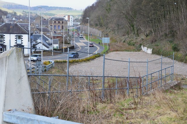
Image: © Jim Barton Taken: 16 Apr 2013
Looking along the A7 in Ladhope Vale from the bridge on Station Brae with the route of the former Waverley Line, now to be reopened as far as Tweedbank as the Borders Railway. See Image for a view of the bridge during construction in 2006.
Images are licensed for reuse under creativecommons.org/licenses/by-sa/2.0
Image Location
Latitude
55.617023
Longitude
-2.803666