The Station Brae, Galashiels in 1962
Introduction
The photograph on this page of The Station Brae, Galashiels in 1962 by Mary Dalgetty Baxter as part of the Geograph project.
The Geograph project started in 2005 with the aim of publishing, organising and preserving representative images for every square kilometre of Great Britain, Ireland and the Isle of Man.

There are currently over 7.5m images from over 14,400 individuals and you can help contribute to the project by visiting https://www.geograph.org.uk
The Station Brae, Galashiels in 1962
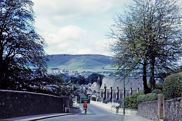
Image: © Mary Dalgetty Baxter Taken: Unknown
There certainly wasn’t much traffic about in those days and a Sitka plantation now covers the top part of Meigle Hill in the background. The bridge just beyond the cyclists over the former Waverley Railway Line was demolished in November 2006 as part of the Galashiels Inner Relief Road Scheme. This photo was taken by my mother and copied from a Kodachrome slide.
Images are licensed for reuse under creativecommons.org/licenses/by-sa/2.0
Image Location
Latitude
55.61649
Longitude
-2.802702