IMAGES TAKEN NEAR TO
Durrington Avenue, LONDON, SW20 8NT
Introduction
This page details the photographs taken nearby to Durrington Avenue, SW20 8NT by members of the Geograph project.
The Geograph project started in 2005 with the aim of publishing, organising and preserving representative images for every square kilometre of Great Britain, Ireland and the Isle of Man.

There are currently over 7.5m images from over14,400 individuals and you can help contribute to the project by visiting https://www.geograph.org.uk
Image Map
Images are licensed for reuse under creativecommons.org/licenses/by-sa/2.0
Notes
- Clicking on the map will re-center to the selected point.
- The higher the marker number, the further away the image location is from the centre of the postcode.
Image Listing (38 Images Found)
Images are licensed for reuse under creativecommons.org/licenses/by-sa/2.0
Image
Details
Distance
1
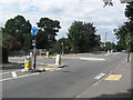
Roundabout, West Wimbledon
Junction of Cottenham Park Road with Pepys Road.
Image: © Richard Rogerson
Taken: 30 Jul 2010
0.04 miles
2
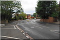
Cottenham Park Road
Hampton Close is the road off to the left. If there were no houses in the way, there would be a view for some miles to the south.
Image: © Bill Boaden
Taken: 14 Aug 2010
0.05 miles
3
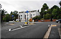
Mini-roundabout on Cottenham Park Road
This is viewed from Pepys Road. Cottenham Park Road runs across the top.
Image: © Bill Boaden
Taken: 14 Aug 2010
0.05 miles
4
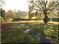
Holland Garden
Just the northeast corner of this park, to the far side of the fine oak tree, is in this square. "On July 19th 1928, Lady Holland passed the field to the Council to be used as a public recreation ground" http://www.friendsofhollandgarden.org.uk/garden.html .
Image: © Derek Harper
Taken: 16 Nov 2010
0.08 miles
5
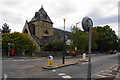
Christ Church, West Wimbledon
On the corner of Copse Hill and Cottenham Park Road.
Image: © Bill Boaden
Taken: 14 Aug 2010
0.12 miles
6
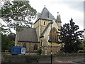
Christ Church, West Wimbledon
The church was dedicated by the Bishop of London, Rt. Revd Archibald Tait on Monday 15th August 1859. .It was built in Kentish ragstone, with buttresses and some other parts of Bath stone. The architect was Samuel S. Teulon, a man of Huguenot descent, who designed a number of churches in the London area. http://www.christchurch-westwimbledon.org/history.htm#barrett
Image: © Richard Rogerson
Taken: 30 Jul 2010
0.13 miles
7
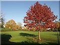
Acer, Holland Garden
A beautiful red maple on the western side of the main grass area of the garden. The oak shown in Image is on the left.
Image: © Derek Harper
Taken: 16 Nov 2010
0.13 miles
8
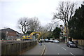
Atterbury Rd
View up Atterbury Rd from close to its junction with the drive. On the left is a cleared building site in the grounds of Rosemary lodge where building work is taking place. This involves the demolition of a small group of terraced houses known a Rosemary Cottages and replacing them with six semi detached houses and one detached house all with basements and accommodation in the roofs.
Image: © Nigel Mykura
Taken: 3 Dec 2015
0.13 miles
9
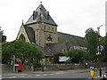
Christ Church, West Wimbledon
On Copse Hill at the junction with Cottenham Park Road (B281).
Image: © G Laird
Taken: 5 Jul 2012
0.13 miles