
IMAGES TAKEN NEAR TO
Durnsford Road, LONDON, SW19 8LL
Introduction
This page details the photographs taken nearby to Durnsford Road, SW19 8LL by members of the Geograph project.
The Geograph project started in 2005 with the aim of publishing, organising and preserving representative images for every square kilometre of Great Britain, Ireland and the Isle of Man.

There are currently over 7.5m images from over14,400 individuals and you can help contribute to the project by visiting https://www.geograph.org.uk
Image Map
Images are licensed for reuse under creativecommons.org/licenses/by-sa/2.0
Notes
- Clicking on the map will re-center to the selected point.
- The higher the marker number, the further away the image location is from the centre of the postcode.
Image Listing (87 Images Found)
Images are licensed for reuse under creativecommons.org/licenses/by-sa/2.0
Image
Details
Distance
1
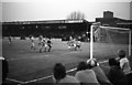
Plough Lane - The former home of Wimbledon FC
Image: © Steve Daniels
Taken: 20 Apr 1982
0.03 miles
2
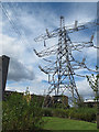
Last pylon in the line
The pylon is the termination of the 275kV network before it goes in to the nearby substation to be transformed to 132kV for onward transmission into London. See Image and Image for other views.
The blocks of flats to the left were built on the site of the former Plough Lane football stadium.
Image: © Stephen Craven
Taken: 29 Aug 2011
0.03 miles
3
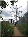
Path to the pylon
The path in this view is part of the Wandle Trail. The pylon is the termination of the 275kV network before it goes in to the nearby substation to be transformed to 132kV for onward transmission into London.
The blocks of flats in the background were built on the site of the former Plough Lane football stadium.
Image: © Stephen Craven
Taken: 29 Aug 2011
0.03 miles
4
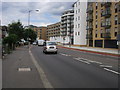
Dunsford Road
Dunsford Road passing the apartments built on Plough Lane the former Wimbledon FC ground
Image: © Shaun Ferguson
Taken: 10 Jul 2009
0.05 miles
5

Plough Lane - The former home of Wimbledon FC
Image: © Steve Daniels
Taken: 20 Apr 1982
0.05 miles
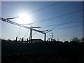
7
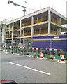
Wimbledon FC (former), SW19
On the corner of Plough Lane and Durnsford Road is the old site of Wimbledon Football Club demolished in 2002 and now turned into a mini housing estate.
Image: © Phillip Perry
Taken: Unknown
0.06 miles
8
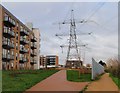
Wandle Trail
The Trail passes the site of Wimbledon FC's ground on the left. This was the club's home from 1912 to 1991. The block of flats on the left (one of six built on the Reynolds Gate site; see also Image) is Stannard House, named after Harry Stannard, a star in the Isthmian League days. http://wapedia.mobi/en/Plough_Lane
Image: © Derek Harper
Taken: 30 Nov 2009
0.06 miles
9
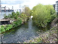
River Wandle looking towards Plough Lane
The section of the River Wandle and the Wandle Trail between Earlsfield and Plough Lane has allotments on the left bank followed by commerce, and commerce on the left bank followed by a housing estate, on the site of the old Wimbledon F. C. ground, before Plough Lane is reached. Here commercial premises are on both sides. This view is just before Plough Lane with a relatively new estate on the right and electricity grid equipment on the other side of the river.
Image: © Marathon
Taken: 11 Apr 2012
0.06 miles
10
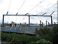
Cables entering Wimbledon substation
275kV cables across the Wandle from the overhead transmission line Image and entering the high voltage substation to be transformed to 132kV for onward transmission into London.
Image: © Stephen Craven
Taken: 29 Aug 2011
0.06 miles