1
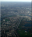
Barnes from the air
The London Wetland Centre is on the right.
Image: © Thomas Nugent
Taken: 24 Nov 2014
0.05 miles
2
209 bus by the Red Lion, Castlenau
Image: © David Howard
Taken: 16 Nov 2008
0.07 miles
3
Scooters, Barnes
This group of scooters is part of a scooter club heading along Castlenau (road) towards Putney.
Image: © David Anstiss
Taken: 14 Apr 2013
0.07 miles
4
Red Lion, Barnes, under snow
The Red Lion, corner of Castelnau and Queen Elizabeth Walk, taken Winter 2002/3.
It has since been renovated and turned into a "gastro-pub".
Image: © Baggy Suggs
Taken: 8 Jan 2003
0.07 miles
5
Barnes: an important road junction
Looking west across the A306, we see Church Road (A3003) straight ahead, which leads to Barnes 'village centre', if that's what you would call it, around the pond. To the left is the unclassified Elm Grove Road, but sharp left is the A306 Rocks Lane, leading to Roehampton and the South Circular. Sharp right the A306 continues as Castelnau (former name: Upper Bridge Road) to Hammersmith Bridge.
Image: © Dr Neil Clifton
Taken: 8 Jan 2013
0.07 miles
6
Red Lion crossroads, Barnes
Looking from Castlenau (A306) towards the Red Lion crossroads. From left to right the streets are Queen Elizabeth Walk (hidden), Rocks Lane (A306), Elm Grove Road, Church Road (A3003) which continues on to Barnes High Street.
Image: © Oliver Dixon
Taken: 23 Nov 2016
0.07 miles
7
Junction of Rocks Lane, Church Rd, Elm Grove Rd & Castelnau, Barnes
Image: © John Lord
Taken: 7 Sep 2010
0.08 miles
8
American Carriage Company
Car dealers on Castelnau, at its junction with Rocks Lane and Church Road.
Image: © M J Richardson
Taken: 14 Aug 2009
0.08 miles
9
209 bus turning into Church Road
Image: © David Howard
Taken: 8 Sep 2008
0.08 miles
10
St Mary, Church Road, Barnes - Church clock
Image: © John Salmon
Taken: 6 May 2011
0.08 miles


