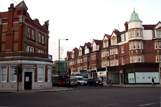
Barnes: an important road junction
Introduction
The photograph on this page of Barnes: an important road junction by Dr Neil Clifton as part of the Geograph project.
The Geograph project started in 2005 with the aim of publishing, organising and preserving representative images for every square kilometre of Great Britain, Ireland and the Isle of Man.
There are currently over 7.5m images from over 14,400 individuals and you can help contribute to the project by visiting https://www.geograph.org.uk

Image: © Dr Neil Clifton Taken: 8 Jan 2013
Looking west across the A306, we see Church Road (A3003) straight ahead, which leads to Barnes 'village centre', if that's what you would call it, around the pond. To the left is the unclassified Elm Grove Road, but sharp left is the A306 Rocks Lane, leading to Roehampton and the South Circular. Sharp right the A306 continues as Castelnau (former name: Upper Bridge Road) to Hammersmith Bridge.

