IMAGES TAKEN NEAR TO
Wyatt Drive, LONDON, SW13 8AL
Introduction
This page details the photographs taken nearby to Wyatt Drive, SW13 8AL by members of the Geograph project.
The Geograph project started in 2005 with the aim of publishing, organising and preserving representative images for every square kilometre of Great Britain, Ireland and the Isle of Man.

There are currently over 7.5m images from over14,400 individuals and you can help contribute to the project by visiting https://www.geograph.org.uk
Image Map
Images are licensed for reuse under creativecommons.org/licenses/by-sa/2.0
Notes
- Clicking on the map will re-center to the selected point.
- The higher the marker number, the further away the image location is from the centre of the postcode.
Image Listing (182 Images Found)
Images are licensed for reuse under creativecommons.org/licenses/by-sa/2.0
Image
Details
Distance
1
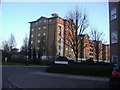
New flats on the Harrods Village development
Image: © David Howard
Taken: 30 Jan 2011
0.05 miles
2
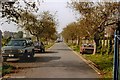
The approach to the old water works, Barn Elms, circa 1992
I took this shot from the gates at the entrance to the water-works - subsequently demolished to make way for residential development. On the left are the old Barn Elms allotments, soon to be re-sited further south and west. Over the wall to the right were some minor water-works buildings, and beyond them the Harrods site. The access road immediately in front of the camera was almost exactly aligned with Merthyr Terrace - part of a white building at the corner of the Terrace and Castelnau can be glimpsed directly ahead.
The alignment of the access road was subsequently adopted for the south-eastward extension of Trinity Church Road. The spot where I was standing now corresponds - I believe - to the intersection of Trinity Church Road and Cartwright Way. Some of the crab apple trees may still be there.
I can't be sure of the exact date of this shot, but it may well have been taken in October 1992.
Image: © Stefan Czapski
Taken: 15 Oct 1992
0.06 miles
3
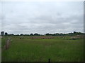
View of Fulham from the London Wetland Centre
Looking north-northeast.
Image: © Robert Lamb
Taken: 9 Jun 2013
0.07 miles
4
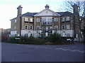
Block of flats, Trinity Church Road, Barnes
Image: © David Howard
Taken: 30 Jan 2011
0.07 miles
5
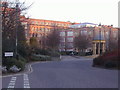
Harrods Depository, Barnes
Now luxury flats
Image: © David Howard
Taken: 30 Jan 2011
0.07 miles
6
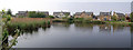
Lake at Junction of Devereux Lane and Wyatt Drive, Barnes
The lake is a sort of annexe to the London Wetland Centre.
Image: © Roger Miller
Taken: 29 Apr 2007
0.08 miles
7
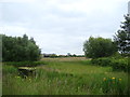
View of houses on Wyatt Drive and the Empress State Building in Marchbank Road, Earl's Court from the London Wetland Centre
Looking north-northeast.
Image: © Robert Lamb
Taken: 9 Jun 2013
0.10 miles
8
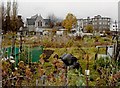
Barn Elms allotments, circa 1992
The view is north-west towards Trinity Church. If the allotments appear neglected, it is because the site was soon to be bulldozed, and the keener allotment-holders had already found plots elsewhere.
When redevelopment took place, provision was made for allotments (though the area was smaller than before) and it may well be that the area in front of the camera continued in cultivation.
I don't know the exact date of this photo, but November 1992 seems likely.
Image: © Stefan Czapski
Taken: 16 Nov 1992
0.10 miles