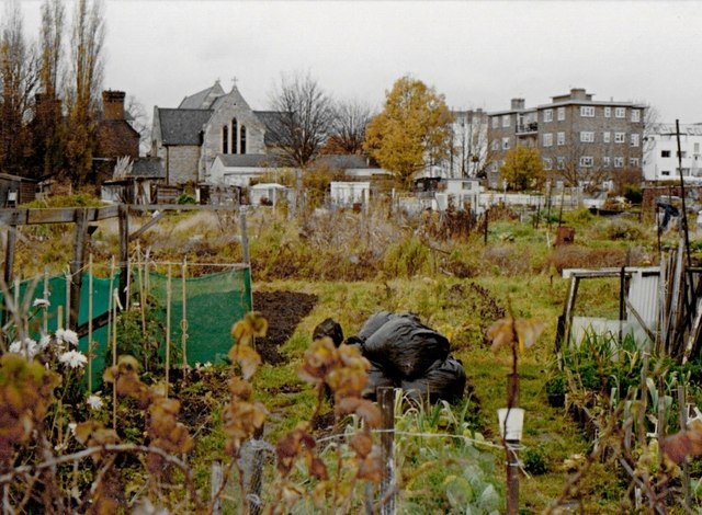
Barn Elms allotments, circa 1992
Introduction
The photograph on this page of Barn Elms allotments, circa 1992 by Stefan Czapski as part of the Geograph project.
The Geograph project started in 2005 with the aim of publishing, organising and preserving representative images for every square kilometre of Great Britain, Ireland and the Isle of Man.
There are currently over 7.5m images from over 14,400 individuals and you can help contribute to the project by visiting https://www.geograph.org.uk

Image: © Stefan Czapski Taken: 16 Nov 1992
The view is north-west towards Trinity Church. If the allotments appear neglected, it is because the site was soon to be bulldozed, and the keener allotment-holders had already found plots elsewhere. When redevelopment took place, provision was made for allotments (though the area was smaller than before) and it may well be that the area in front of the camera continued in cultivation. I don't know the exact date of this photo, but November 1992 seems likely.

