
IMAGES TAKEN NEAR TO
Park Street, UTTOXETER, ST14 7AQ
Introduction
This page details the photographs taken nearby to Park Street, ST14 7AQ by members of the Geograph project.
The Geograph project started in 2005 with the aim of publishing, organising and preserving representative images for every square kilometre of Great Britain, Ireland and the Isle of Man.

There are currently over 7.5m images from over14,400 individuals and you can help contribute to the project by visiting https://www.geograph.org.uk
Image Map
Images are licensed for reuse under creativecommons.org/licenses/by-sa/2.0
Notes
- Clicking on the map will re-center to the selected point.
- The higher the marker number, the further away the image location is from the centre of the postcode.
Image Listing (15 Images Found)
Images are licensed for reuse under creativecommons.org/licenses/by-sa/2.0
Image
Details
Distance
1
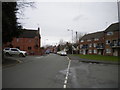
Park Street, Uttoxeter
Seen from the junction with Pennycroft Lane (right).
Image: © Richard Vince
Taken: 22 Feb 2020
0.05 miles
2
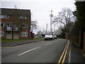
Pennycroft Lane, Uttoxeter
A cul de sac off Park Street that is also host to a public footpath that continues beyond the end of the road.
Image: © Richard Vince
Taken: 22 Feb 2020
0.06 miles
3
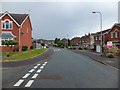
Mellor Drive
View along Mellor Drive looking North-West
Image: © Derek Henry
Taken: 8 Jul 2014
0.08 miles
4
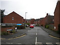
Laurel Grove, Uttoxeter
Seen from Park Street.
Image: © Richard Vince
Taken: 22 Feb 2020
0.12 miles
5

Uttoxeter fire station
Uttoxeter fire station, Cheadle Road, Uttoxeter, Staffordshire. The main station is being totally rebuilt. This view shows the temporary station which is being used during the building works.
Image: © Kevin Hale
Taken: 27 May 2010
0.14 miles
6

Uttoxeter Community Fire Station
This is the completed version of Kevin Hale's picture. http://www.geograph.org.uk/photo/1910015
Image: © Mick Malpass
Taken: 9 Apr 2012
0.14 miles
7
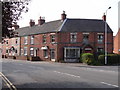
I'm still standing
But for how much longer? This building is obviously structurally unsound and I wonder if a dangerous building order has been served. There are big cracks all round.
Image: © Ian Paterson
Taken: 21 May 2012
0.15 miles
8
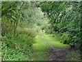
Trackbed of the former Churnet Valley Line
The North Staffordshire Railway Churnet Valley Line opened in 1849. The section between Uttoxeter and Oakamoor closed in 1965. This part of it is used as an informal footpath.
Image: © Ian Calderwood
Taken: 16 Sep 2017
0.15 miles
9
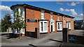
Heath House
Heath House Training and Conference Centre
Image: © Derek Henry
Taken: 15 Aug 2015
0.17 miles
10
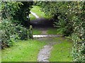
Old lane crossing a former railway
A surviving section of an old lane crossing a former section of the North Staffordshire Railway Churnet Valley Line.
Image: © Ian Calderwood
Taken: 16 Sep 2017
0.18 miles