
IMAGES TAKEN NEAR TO
Ashbourne Road, STOKE-ON-TRENT, ST10 3EZ
Introduction
This page details the photographs taken nearby to Ashbourne Road, ST10 3EZ by members of the Geograph project.
The Geograph project started in 2005 with the aim of publishing, organising and preserving representative images for every square kilometre of Great Britain, Ireland and the Isle of Man.

There are currently over 7.5m images from over14,400 individuals and you can help contribute to the project by visiting https://www.geograph.org.uk
Image Map
Images are licensed for reuse under creativecommons.org/licenses/by-sa/2.0
Notes
- Clicking on the map will re-center to the selected point.
- The higher the marker number, the further away the image location is from the centre of the postcode.
Image Listing (9 Images Found)
Images are licensed for reuse under creativecommons.org/licenses/by-sa/2.0
Image
Details
Distance
1
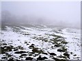
The original 1778 Caldon Low Tramroad
This shallow feature picked out by the snow is in the right place to be the remains of the original 1778 horse-drawn waggonway, which carried limestone from the quarries at Caldon Low to the Caldon Canal at Froghall Old Wharf. It was quickly recognised to be poorly engineered and difficult to operate in bad weather, which is why it was quickly replaced by the 1785 line, shown in Image
Image: © Ian Calderwood
Taken: 8 Feb 2015
0.15 miles
2
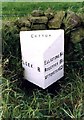
Old Milepost by Windy Harbour, Cotton parish
Cast iron post by the UC road, in parish of Cotton (Staffordshire Moorlands District), Windy Harbour, on the verge in front of drystone wall, on Southwest side of road. Lathe iron casting, erected by the County Council in the 19th/20th century.
Inscription reads:-
: LEEK 8 : : COTTON : : ELLASTONE 5¼ / ROCESTER 8¼ / UTTOXETER 12¾ :
Maker:-
: Chas. Lathe, Tipton. :
Grade II listed.
List Entry Number: 1191638 https://historicengland.org.uk/listing/the-list/list-entry/1191638
Milestone Society National ID: ST_LKUT08
Image: © J Higgins
Taken: 1 Jan 2000
0.18 miles
3
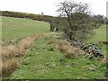
Embankment on the 1785 Caldon Low Railway
There were four phases of tramroad building between Caldon Low Quarry and the Caldon Canal at Froghall. The second of these was a single-track wooden waggon-way, topped with iron, which ran along this low embankment. The waggons were horse-drawn singly, with no signalling or other controls. Traffic travelling in opposite directions was handled by providing passing loops at intervals along the line.
Image: © Ian Calderwood
Taken: 26 Apr 2008
0.19 miles
4
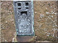
Ordnance Survey Flush Bracket S097
This can be found on the wall of the former Green Man Inn.
Image: © Peter Wood
Taken: 29 Jan 2012
0.22 miles
6
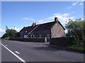
Windy Harbour House
Formerly The Green Man public house.
Image: © Ian Calderwood
Taken: 15 Aug 2015
0.23 miles
7
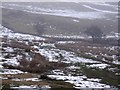
Shallow embankment on the 1785 Caldon Low Tramroad
The 1785 tramroad was a horse-drawn waggonway which carried limestone from the quarries at Caldon Low to the Caldon Canal at Froghall, from 1785 until 1804, until it was replaced by a more efficient plateway.
Image: © Ian Calderwood
Taken: 8 Feb 2015
0.24 miles
8
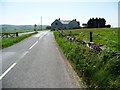
Farmhouse on Ellastone Road
At the junction with The Casey [causeway].
Image: © Christine Johnstone
Taken: 27 May 2012
0.24 miles
9
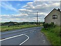
Road Junction Overlooking Cauldon
The Casey is seen joining Ellastone Road here with Cauldon Low on the horizon. The dwelling on the right is Moorland Cottage.
Image: © Jonathan Clitheroe
Taken: 10 Aug 2023
0.24 miles