IMAGES TAKEN NEAR TO
Essex Way, BENFLEET, SS7 1LX
Introduction
This page details the photographs taken nearby to Essex Way, SS7 1LX by members of the Geograph project.
The Geograph project started in 2005 with the aim of publishing, organising and preserving representative images for every square kilometre of Great Britain, Ireland and the Isle of Man.

There are currently over 7.5m images from over14,400 individuals and you can help contribute to the project by visiting https://www.geograph.org.uk
Image Map
Images are licensed for reuse under creativecommons.org/licenses/by-sa/2.0
Notes
- Clicking on the map will re-center to the selected point.
- The higher the marker number, the further away the image location is from the centre of the postcode.
Image Listing (115 Images Found)
Images are licensed for reuse under creativecommons.org/licenses/by-sa/2.0
Image
Details
Distance
2
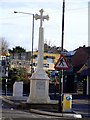
War Memorial
I was coming back from Canvey when I saw this. It is almost impossible to get a good one of this because as you can see it's in the middle of a road, a three-way junction to be precise. I was trying to get closer but the cars just kept on coming. John did a lot better than me. Image
Image: © Julieanne Savage
Taken: 20 Jan 2007
0.04 miles
3
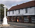
War Memorial, South Benfleet
And Anchor Inn. The memorial stands in the middle of a busy road close to an even busier mini-roundabout. Not a place for quiet remembrance.
Image: © John Myers
Taken: 24 Sep 2006
0.04 miles
4
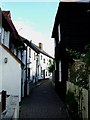
The Close Benfleet
A hidden delight of an alley between Benfleet Station and the Church, to the right is a traditional Essex weather board house
Image: © Glyn Baker
Taken: 22 Aug 2005
0.04 miles
5
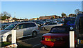
Benfleet station car park
This is taken from the bottom corner of the car park, by the exit to Benfleet station. The white posts in the foreground are part of the cycle parking area. The buildings in the background centre and right are on School Lane. The buildings on the left background are on the High Street. This car park is always full during the day. At one time, it was said that Benfleet station was the busiest commuter station in Essex, or the south-east, or Britain (depending on who you believe).
Image: © John Rostron
Taken: 17 Nov 2009
0.05 miles
6
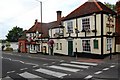
The Hoy and Helmet, Benfleet
A popular old pub.
Image: © Trevor Harris
Taken: 16 Aug 2008
0.05 miles
7
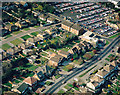
Aerial view of Essex Way and School Lane car park, Benfleet
School Lane car park occupies the upper right of the picture, with School Lane bordering it. The entrance is just visible on School Lane just above left of the two large buildings. The main road running along the lower right is Essex Way, leading up to the Water Tower Image The buildings at the corner of Essex Way and School Lane are the doctors' surgery and Del Tailors, seen in Image
Image: © Edward Clack
Taken: 29 Mar 1990
0.05 miles
8
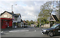
Benfleet High Road on to the Station
The mini-roundabout here is where Benfleet High Road (to the left) meets Essex Way (behind the photographer). The road going straight ahead is High Street Image The building on the left as it bends round is the Half Crown pub Image The one on the right (just about visible) is the Hoy and Helmet pub Image The photographer is standing just outside the Anchor pub Image
Image: © John Rostron
Taken: 5 Nov 2009
0.05 miles