Aerial view of Essex Way and School Lane car park, Benfleet
Introduction
The photograph on this page of Aerial view of Essex Way and School Lane car park, Benfleet by Edward Clack as part of the Geograph project.
The Geograph project started in 2005 with the aim of publishing, organising and preserving representative images for every square kilometre of Great Britain, Ireland and the Isle of Man.

There are currently over 7.5m images from over 14,400 individuals and you can help contribute to the project by visiting https://www.geograph.org.uk
Aerial view of Essex Way and School Lane car park, Benfleet
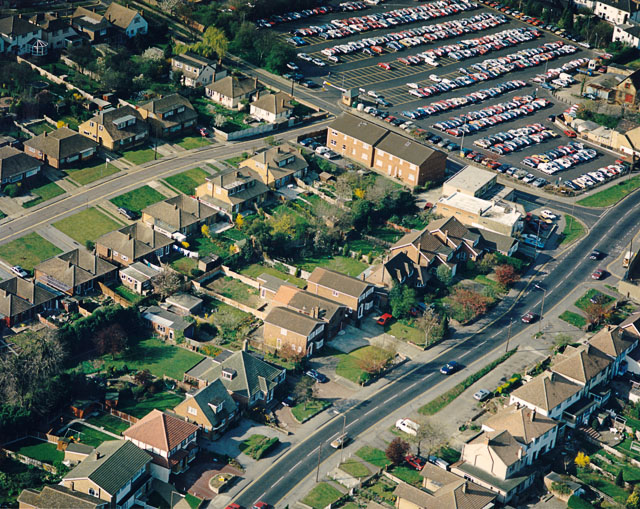
Image: © Edward Clack Taken: 29 Mar 1990
School Lane car park occupies the upper right of the picture, with School Lane bordering it. The entrance is just visible on School Lane just above left of the two large buildings. The main road running along the lower right is Essex Way, leading up to the Water Tower Image The buildings at the corner of Essex Way and School Lane are the doctors' surgery and Del Tailors, seen in Image
Images are licensed for reuse under creativecommons.org/licenses/by-sa/2.0
Image Location
Latitude
51.545202
Longitude
0.564626