Benfleet High Road on to the Station
Introduction
The photograph on this page of Benfleet High Road on to the Station by John Rostron as part of the Geograph project.
The Geograph project started in 2005 with the aim of publishing, organising and preserving representative images for every square kilometre of Great Britain, Ireland and the Isle of Man.

There are currently over 7.5m images from over 14,400 individuals and you can help contribute to the project by visiting https://www.geograph.org.uk
Benfleet High Road on to the Station
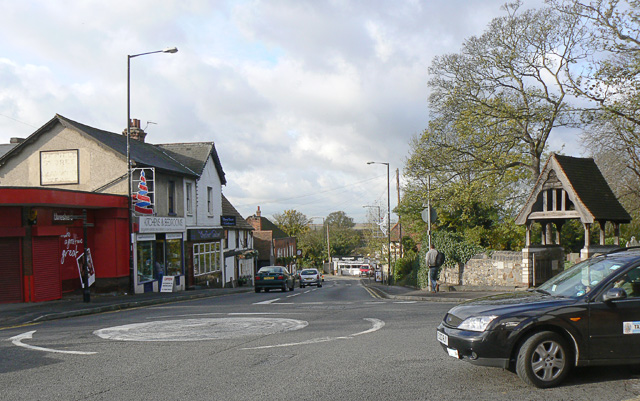
Image: © John Rostron Taken: 5 Nov 2009
The mini-roundabout here is where Benfleet High Road (to the left) meets Essex Way (behind the photographer). The road going straight ahead is High Street Image The building on the left as it bends round is the Half Crown pub Image The one on the right (just about visible) is the Hoy and Helmet pub Image The photographer is standing just outside the Anchor pub Image
Images are licensed for reuse under creativecommons.org/licenses/by-sa/2.0
Image Location
Latitude
51.545522
Longitude
0.562336