IMAGES TAKEN NEAR TO
High Street East, SUNDERLAND, SR1 2AU
Introduction
This page details the photographs taken nearby to High Street East, SR1 2AU by members of the Geograph project.
The Geograph project started in 2005 with the aim of publishing, organising and preserving representative images for every square kilometre of Great Britain, Ireland and the Isle of Man.

There are currently over 7.5m images from over14,400 individuals and you can help contribute to the project by visiting https://www.geograph.org.uk
Image Map
Images are licensed for reuse under creativecommons.org/licenses/by-sa/2.0
Notes
- Clicking on the map will re-center to the selected point.
- The higher the marker number, the further away the image location is from the centre of the postcode.
Image Listing (147 Images Found)
Images are licensed for reuse under creativecommons.org/licenses/by-sa/2.0
Image
Details
Distance
1
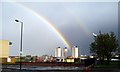
Rainbows over Sunderland, 8th May 2005.
Image: © Martin Routledge
Taken: 8 May 2005
0.03 miles
2
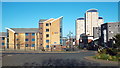
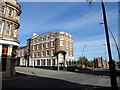
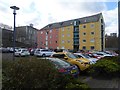
High Street East, Sunderland
A view taken at The Exchange roundbaout, looking eastwards along High Street East.
Image: © Malc McDonald
Taken: 18 Apr 2014
0.05 miles
4
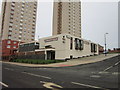
View north from the Coronation Road footbridge
Looking north along Hendon Road. This is to the east of the city centre.
Image: © Robert Graham
Taken: 3 Oct 2016
0.06 miles
5
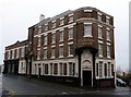
Lampton House, Sunderland Street
On the corner of Sunderland Street and High Street West, this is mainly early C19, although parts of the building are C18. Originally built as a town house for the Lampton family of local landowners, it became first a coaching Inn and then The Bridge Hotel and Vaults. The original name can be seen below the windows on the left elevation. After the landlord was murdered in 1998, the Hotel closed and was later converted to offices, as it is today. It was renamed after the original owners.
Image: © Robert Graham
Taken: 3 Oct 2016
0.08 miles
6
Lambton House
The offices of the Sunderland Youth Offending Service are housed in the former Bridge Hotel.
Image: © Graham Hogg
Taken: 21 Nov 2012
0.08 miles
7
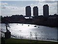
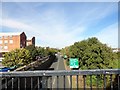
Looking over the River Wear from Monkwearmouth to Sunderland, 17th April 2006
Image: © Martin Routledge
Taken: 17 Apr 2006
0.09 miles
9
Wylam Wharf, Sunderland
Amongst the new apartment blocks along the southern river front in Sunderland, this converted warehouse is one of the few original buildings remaining. Wylam Wharf was first recorded in 1601 and was used to trade in coal and general goods. Its central location made it one of the busiest of Sunderland's Wharves.
Image: © Oliver Dixon
Taken: 23 Feb 2016
0.09 miles
10
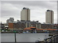
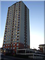
Urban development on banks of River Wear
Image: © rob bishop
Taken: 22 Apr 2013
0.09 miles