Wylam Wharf, Sunderland
Introduction
The photograph on this page of Wylam Wharf, Sunderland by Oliver Dixon as part of the Geograph project.
The Geograph project started in 2005 with the aim of publishing, organising and preserving representative images for every square kilometre of Great Britain, Ireland and the Isle of Man.

There are currently over 7.5m images from over 14,400 individuals and you can help contribute to the project by visiting https://www.geograph.org.uk
Wylam Wharf, Sunderland
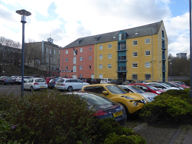
Image: © Oliver Dixon Taken: 23 Feb 2016
Amongst the new apartment blocks along the southern river front in Sunderland, this converted warehouse is one of the few original buildings remaining. Wylam Wharf was first recorded in 1601 and was used to trade in coal and general goods. Its central location made it one of the busiest of Sunderland's Wharves.
Images are licensed for reuse under creativecommons.org/licenses/by-sa/2.0
Image Location
Latitude
54.909337
Longitude
-1.373587