1
Sixpenny Handley after sunset
Image: © Simon Barnes
Taken: 9 Apr 2007
0.04 miles
2
Sixpenny Handley, Dean Lane
From the village to Bowerchalke, with modern housing developments on both sides.
Image: © Mike Faherty
Taken: 5 May 2011
0.05 miles
3
Sixpenny Handley at sunset
Combination of haze and graduated ND filters made it possible to capture the sun just above the horizon. No other trickery !
Image: © Simon Barnes
Taken: 9 Apr 2007
0.05 miles
4
Old Direction Sign - Signpost by the B3081, High Street, Sixpenny Handley Parish
Annulus and bar finial - 4 arms; Dorset halo with NGR by the B3081, in parish of Sixpenny Handley (East Dorset District), Sixpenny Handley, junction of UC roads to Blandford and Bowerchalke on verge by parish office.
Surveyed
Milestone Society National ID: DO_SU0017
Image: © Milestone Society
Taken: Unknown
0.07 miles
5
Sixpenny Handley, fingerpost
One of two in the village; see also
Image This one is at the bottom of High Street, at the junction with Dean Lane (seen here). Giving county name, location (written as 6D Handley), and grid reference (000171), which is not quite correct, according to my GPS; if not rounded up, it should read 999170.
Image: © Mike Faherty
Taken: 26 Jun 2010
0.08 miles
6
Bus shelter, Sixpenny Handley
Santa stands guard over the Nativity scene within the bus shelter.
Image: © Maigheach-gheal
Taken: 27 Dec 2009
0.08 miles
7
Sixpenny Handley: signpost at Dean Lane
One of the traditional signposts which has the Dorset finial giving location name and grid reference. The finial was on display in the village shop window for a time (see
Image) but has now been replaced on the signpost. See
Image for a close-up of it in situ.
Image: © Chris Downer
Taken: 8 Jun 2013
0.08 miles
8
Sixpenny Handley: detail of Dean Lane finger-post
A close-up of the finial atop the
Image, giving location ('6d.' for Sixpenny) and grid reference. It was for a time on display in the village shop - see
Image
Image: © Chris Downer
Taken: 8 Jun 2013
0.08 miles
9
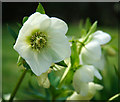
Helleborus orientalis
Evergreen, clump-forming perennial with dense, divided foliage, above which rise nodding, cup-shaped, white flowers.
Image: © Simon Barnes
Taken: 24 Mar 2007
0.08 miles
10
Yellow Archangel (Galeobdolon luteum), Sixpenny Handley
A plant 1-2 feet high found throughout England and Wales, but rare in Scotland and Ireland. Also know as weasel-snout, it flowers from April to June. 'Galeobdolon' derives from two Greek works meaning weasel and stench - probably a reference to the unpleasant smell produced when the stems or leaves are rubbed between the fingers.
Image: © Maigheach-gheal
Taken: 17 May 2010
0.09 miles


