Old Direction Sign - Signpost by the B3081, High Street, Sixpenny Handley Parish
Introduction
The photograph on this page of Old Direction Sign - Signpost by the B3081, High Street, Sixpenny Handley Parish by Milestone Society as part of the Geograph project.
The Geograph project started in 2005 with the aim of publishing, organising and preserving representative images for every square kilometre of Great Britain, Ireland and the Isle of Man.

There are currently over 7.5m images from over 14,400 individuals and you can help contribute to the project by visiting https://www.geograph.org.uk
Old Direction Sign - Signpost by the B3081, High Street, Sixpenny Handley Parish
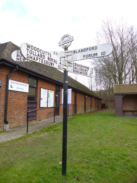
Image: © Milestone Society Taken: Unknown
Annulus and bar finial - 4 arms; Dorset halo with NGR by the B3081, in parish of Sixpenny Handley (East Dorset District), Sixpenny Handley, junction of UC roads to Blandford and Bowerchalke on verge by parish office. Surveyed Milestone Society National ID: DO_SU0017
Images are licensed for reuse under creativecommons.org/licenses/by-sa/2.0
Image Location
Latitude
50.953016
Longitude
-2.001373