IMAGES TAKEN NEAR TO
SO4 8YF
Introduction
This page details the photographs taken nearby to SO4 8YF by members of the Geograph project.
The Geograph project started in 2005 with the aim of publishing, organising and preserving representative images for every square kilometre of Great Britain, Ireland and the Isle of Man.

There are currently over 7.5m images from over14,400 individuals and you can help contribute to the project by visiting https://www.geograph.org.uk
Image Map
Images are licensed for reuse under creativecommons.org/licenses/by-sa/2.0
Notes
- Clicking on the map will re-center to the selected point.
- The higher the marker number, the further away the image location is from the centre of the postcode.
Image Listing (42 Images Found)
Images are licensed for reuse under creativecommons.org/licenses/by-sa/2.0
Image
Details
Distance
1
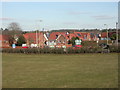
Buckland, Ambrose Corner
New housing development at the corner of Southampton Road & Marsh Lane. http://www.colten.co.uk/developments/?type=1
Image: © Mike Faherty
Taken: 4 Mar 2010
0.02 miles
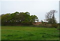
4
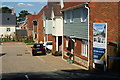
Ambrose Corner, Lower Buckland, Hampshire
A new housing development, off Marsh Lane. So new, that the road does not appear on the map (April 2010).
Image: © Peter Trimming
Taken: 8 Apr 2010
0.04 miles
7
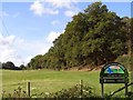
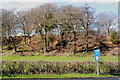
Southern side of Buckland Rings
The beeches and oaks on the right are growing on the southern rampart of Buckland Rings iron-age camp. The signboard in the foreground is a creation of Hampshire County Council who bought the land around the site in 1989 and have made it part of the Buckland Conservation Area.
Image: © Jim Champion
Taken: 8 Oct 2006
0.06 miles
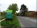
8
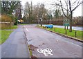
Lay-by at Buckland
This lay-by used to be the main road, but that has now been moved a few yards to the west, as can be seen above. It also marks the boundary of Lymington Town. The blue boat is for a floral display, and has been placed there by Lymington Rotary Club.
Image: © mike smith
Taken: 17 Dec 2013
0.07 miles
9
Buckland Rings, Buckland, Hampshire
Scheduled ancient monument.
http://www.megalithic.co.uk/article.php?sid=4737
Image: © Peter Trimming
Taken: 8 Apr 2010
0.09 miles
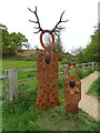
10
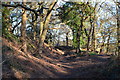
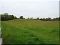
Between the earth embankments at Buckland Rings
Image: © David Martin
Taken: 17 Feb 2013
0.10 miles