1
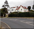
Walhampton, The Walhampton Arms
Calling itself a country inn; once, according to an information board, model dairy at Home Farm, Walhampton. Internally, polygonal bar, serving Ringwood Best & Forty Niner, Butcombe Best, Gale's HSB; eating areas to left & right, patio at front. Note the dove-cote & weather-vane. Listed by English Heritage, http://www.imagesofengland.org.uk/Details/Default.aspx?id=144248&mode=adv For some customer reviews, see http://www.beerintheevening.com/pubs/s/31/31047/Walhampton_Arms/Walhampton_Hill
Image: © Mike Faherty
Taken: 5 Jul 2009
0.02 miles
2
Walhampton House, grounds
A flat open space, possibly with equine connections; stands and an outbuilding are visible to the right. As seen from Monument Lane.
Image: © Mike Faherty
Taken: 5 Jul 2009
0.05 miles
3
Hordle and Wallhampton School, Lymington, Hants
Image: © Rosemary Nelson
Taken: 5 Nov 2005
0.14 miles
4
Little Ashton, Walhampton
Viewed across the B3054 Undershore.
The 18th century house, with later modifications, was Grade II listed in 1959.
Image: © Jaggery
Taken: 27 Sep 2014
0.22 miles
5
B3054 towards Beaulieu
Image: © JThomas
Taken: 28 Apr 2022
0.24 miles
6
Junction of the B3054 and Undershore Road, Walhampton
Viewed across the B3054 looking along Undershore Road. To the left,
the B3054 is Undershore leading to Walhampton Hill on the road to Beaulieu.
The B3054 in the lower right corner is Bridge Road, towards Lymington, Lyndhurst and Southampton.
Ahead, Undershore Road leads to the Isle of Wight Ferry terminal and Lymington Pier railway station.
Image: © Jaggery
Taken: 27 Sep 2014
0.24 miles
7
Walhampton: postbox № SO41 18, Undershore Road
This George V-reign postbox is set into a rather large brick pillar (which might have been a gatepost, but there is no matching pair) and is emptied finally at 5:30pm on weekdays and at 10:15am on Saturdays.
Image: © Chris Downer
Taken: 2 Jul 2011
0.25 miles
8
George V postbox on Undershore Road
Postbox No. SO41 18.
Image: © JThomas
Taken: 28 Apr 2022
0.25 miles


