Walhampton, The Walhampton Arms
Introduction
The photograph on this page of Walhampton, The Walhampton Arms by Mike Faherty as part of the Geograph project.
The Geograph project started in 2005 with the aim of publishing, organising and preserving representative images for every square kilometre of Great Britain, Ireland and the Isle of Man.

There are currently over 7.5m images from over 14,400 individuals and you can help contribute to the project by visiting https://www.geograph.org.uk
Walhampton, The Walhampton Arms
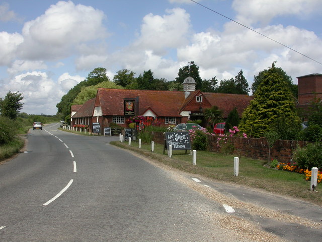
Image: © Mike Faherty Taken: 5 Jul 2009
Calling itself a country inn; once, according to an information board, model dairy at Home Farm, Walhampton. Internally, polygonal bar, serving Ringwood Best & Forty Niner, Butcombe Best, Gale's HSB; eating areas to left & right, patio at front. Note the dove-cote & weather-vane. Listed by English Heritage, http://www.imagesofengland.org.uk/Details/Default.aspx?id=144248&mode=adv For some customer reviews, see http://www.beerintheevening.com/pubs/s/31/31047/Walhampton_Arms/Walhampton_Hill
Images are licensed for reuse under creativecommons.org/licenses/by-sa/2.0
Image Location
Latitude
50.767421
Longitude
-1.532716