IMAGES TAKEN NEAR TO
SO2 4JE
Introduction
This page details the photographs taken nearby to SO2 4JE by members of the Geograph project.
The Geograph project started in 2005 with the aim of publishing, organising and preserving representative images for every square kilometre of Great Britain, Ireland and the Isle of Man.

There are currently over 7.5m images from over14,400 individuals and you can help contribute to the project by visiting https://www.geograph.org.uk
Image Map
Images are licensed for reuse under creativecommons.org/licenses/by-sa/2.0
Notes
- Clicking on the map will re-center to the selected point.
- The higher the marker number, the further away the image location is from the centre of the postcode.
Image Listing (40 Images Found)
Images are licensed for reuse under creativecommons.org/licenses/by-sa/2.0
Image
Details
Distance
1
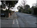
Thorold Road
Dimond Hill junction with Thorold Road
Image: © Shaun Ferguson
Taken: 3 Apr 2008
0.08 miles
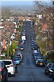
3
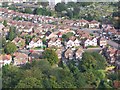
View over Midanbury Lane and Avon Road
The central row of houses are on Midanbury Lane with Avon Road beyond. These streets are on a hill and aircraft approaching Southampton airport, as here, can appear alarmingly low!
Image: © David Martin
Taken: 20 Sep 2009
0.12 miles
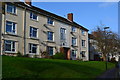
4
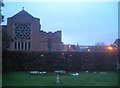
Bitterne Park: Church of the Ascension and garden of remembrance
The garden of remembrance lies to the east of the church, its entrance off Thorold Road.
Image: © Christopher Hilton
Taken: 9 Feb 2011
0.15 miles
5
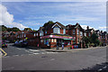
Corner shop on St Catherine's Road
Situated within the large and mature residential area of Bitterne Park.
Image: © Bill Boaden
Taken: 29 Sep 2016
0.16 miles
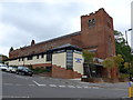
6
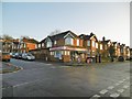
Bitterne Park, London Off-Licence
Corner shop at the junction of Bond and St. Catherines Roads.
Image: © Mike Faherty
Taken: 31 Dec 2016
0.16 miles
7
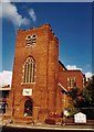
The Ascension, Bitterne Park
Built in 1924. Construction work in progress.
Image: © Michael FORD
Taken: Unknown
0.17 miles
8
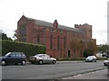
Church of the Ascension, Bitterne Park
Viewed from Thorold Road, a residential road running uphill from the main Cobden Avenue. The tower was originally intended to be higher.
Image: © Rosemary Oakeshott
Taken: 17 Oct 2007
0.18 miles