
IMAGES TAKEN NEAR TO
Green Drove, PEWSEY, SN9 5JB
Introduction
This page details the photographs taken nearby to Green Drove, SN9 5JB by members of the Geograph project.
The Geograph project started in 2005 with the aim of publishing, organising and preserving representative images for every square kilometre of Great Britain, Ireland and the Isle of Man.

There are currently over 7.5m images from over14,400 individuals and you can help contribute to the project by visiting https://www.geograph.org.uk
Image Map
Images are licensed for reuse under creativecommons.org/licenses/by-sa/2.0
Notes
- Clicking on the map will re-center to the selected point.
- The higher the marker number, the further away the image location is from the centre of the postcode.
Image Listing (42 Images Found)
Images are licensed for reuse under creativecommons.org/licenses/by-sa/2.0
Image
Details
Distance
1
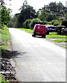
Red Royal Mail van, Green Drove near Pewsey
Parked while its driver delivers letters and small parcels to nearby houses.
Image: © Jaggery
Taken: 15 Sep 2018
0.01 miles
2
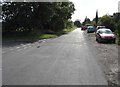
SE along Green Drove near Pewsey
Out of shot ahead, Green Drove leads to Southcott Road and Ball Road,
a circuitous route to the eastern end of High Street Pewsey.
The Swan Meadow junction https://www.geograph.org.uk/photo/6237184 is on the left.
Image: © Jaggery
Taken: 15 Sep 2018
0.01 miles
3
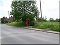
Telephone box, Pewsey
The K6 type telephone box stands on Green Drove.
In 1935, the Post Office commissioned a new kiosk from Sir Giles Gilbert Scott to celebrate the Jubilee of King George V. The K6 Jubilee Kiosk, as it is known, was similar to the K2 box, being made of cast iron and painted red but was 25% lighter in weight. By the end of the 1930s there were 20,000 K6 telephone boxes in use all over the UK.
Image: © Maigheach-gheal
Taken: 6 Jun 2010
0.02 miles
4
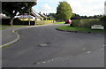
Junction of Green Drove and Swan Meadow south of Pewsey
Swan Meadow leads to Woodlands Road and Tinkers Mead.
Image: © Jaggery
Taken: 15 Sep 2018
0.04 miles
5
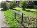
Green Drove name sign south of Pewsey
Near the corner of Swan Road and Everleigh Road.
Image: © Jaggery
Taken: 15 Sep 2018
0.05 miles
6
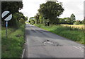
Everleigh Road south of Pewsey
A sign https://www.geograph.org.uk/photo/5909312 near the camera on the corner of Green Drove shows that this is the road to Everleigh and Andover. The label on the National Speed Limit sign's pole shows that the road ahead is part of National Cycle Network Route 45 which extends for 435km (270 miles) from Chester to Salisbury. Here in Wiltshire, Route 45 links Swindon with Salisbury via the World Heritage site at Avebury and crosses the North Wessex Downs and Salisbury Plain.
Image: © Jaggery
Taken: 15 Sep 2018
0.05 miles
7
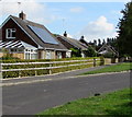
Rooftop solar panels, Swan Meadow near Pewsey
Optimally located on a south-facing roof.
Image: © Jaggery
Taken: 15 Sep 2018
0.05 miles
8
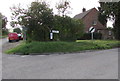
Corner of Green Drove and Everleigh Road south of Pewsey
The sign pointing right along Everleigh Road https://www.geograph.org.uk/photo/5909308 shows ANDOVER EVERLEIGH.
The red Royal Mail van is parked in Green Drove.
Image: © Jaggery
Taken: 15 Sep 2018
0.05 miles
9
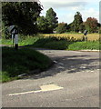
Junction of Green Drove and Everleigh Road south of Pewsey
The 30mph speed limit increases to the National Speed Limit on Everleigh Road.
Image: © Jaggery
Taken: 15 Sep 2018
0.05 miles
10
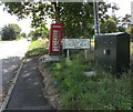
Swan Yard leading to Cygnet Place direction sign, Swan Road near Pewsey
This unclassified part of Swan Road is southeast of the A345 Swan Road behind the camera.
The former red phonebox is in use as an information box https://www.geograph.org.uk/photo/6237133 in September 2018.
Image: © Jaggery
Taken: 15 Sep 2018
0.07 miles