1
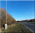
Swindon cyclepath
Cyclepath in Swindon leading towards Frankland Road.
Image: © Wayland Smith
Taken: 4 Apr 2020
0.15 miles
2
Cycleway near Freshbrook
Image: © Mick Garratt
Taken: 23 Jan 2015
0.15 miles
3
Great Western Way into Swindon
Image: © Steve Daniels
Taken: 1 May 2014
0.18 miles
4
Water Research Centre, Frankland Road, Swindon
The building was constructed in the 1980s as the home for the Water Research Centre who, in a similar way to British Homes Stores becoming bhs, are now the WRc. The building sits on the gridline between this and SU1182 but everything visible here is in this square.
Image: © Brian Robert Marshall
Taken: 20 Aug 2007
0.18 miles
5
Roadside weather monitoring equipment, Swindon
Among the sensors on a pole alongside the A3102 Great Western Way are an anemometer (for measuring wind speed) and a vane (for showing wind direction). Lower down is an air temperature sensor.
Image: © Jaggery
Taken: 2 Feb 2013
0.20 miles
6
Water Research Centre, Frankland Road, Swindon
The WRc (as it now is) building sits on the gridline between this square and the next one north. This view is parallel with the northern gridline of this square. Everything to the right of the red component on the front elevation is in this square as is the viewpoint.
Image: © Brian Robert Marshall
Taken: 20 Aug 2007
0.20 miles
7
Beware of deer, Swindon
The warning sign is alongside the A3012 Great Western Way in the south of Swindon.
Image: © Jaggery
Taken: 2 Feb 2013
0.21 miles
8
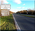
Welcome to Swindon
The busy dual-carriageway connecting Swindon with junction 16 of the M4.
Image: © Roger Cornfoot
Taken: 2 Jan 2007
0.21 miles
9
A view towards west Swindon
This image was obtained from the high ground south of Wroughton with the Marlborough Downs behind the viewpoint and is facing north-west. In the foreground are residential properties in Church Hill, Wroughton at map reference SU140803. The nearest commercial building above the trees in the centre is Batleys Cash and Carry in Frankland Road, Blagrove at SU115828 with, just behind it the yellowish Anchor Butter factory. Even further away is the Windmill Business Park at SU106834. The windmill that gives its name to the Park is visible near the top left corner of the image. The distance between the windmill and the viewpoint is 5.45 kilometres.
Image: © Brian Robert Marshall
Taken: 23 Aug 2007
0.24 miles
10
Western boundary of Swindon
The A3102 Great Western Way reaches the western edge of Swindon, Wiltshire, one of the largest towns in the UK. The population of the Borough of Swindon was 209,000 on the day of the 2011 census, an increase of 29,000 in ten years.
Image: © Jaggery
Taken: 2 Feb 2013
0.24 miles


