A view towards west Swindon
Introduction
The photograph on this page of A view towards west Swindon by Brian Robert Marshall as part of the Geograph project.
The Geograph project started in 2005 with the aim of publishing, organising and preserving representative images for every square kilometre of Great Britain, Ireland and the Isle of Man.

There are currently over 7.5m images from over 14,400 individuals and you can help contribute to the project by visiting https://www.geograph.org.uk
A view towards west Swindon
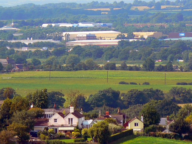
Image: © Brian Robert Marshall Taken: 23 Aug 2007
This image was obtained from the high ground south of Wroughton with the Marlborough Downs behind the viewpoint and is facing north-west. In the foreground are residential properties in Church Hill, Wroughton at map reference SU140803. The nearest commercial building above the trees in the centre is Batleys Cash and Carry in Frankland Road, Blagrove at SU115828 with, just behind it the yellowish Anchor Butter factory. Even further away is the Windmill Business Park at SU106834. The windmill that gives its name to the Park is visible near the top left corner of the image. The distance between the windmill and the viewpoint is 5.45 kilometres.
Images are licensed for reuse under creativecommons.org/licenses/by-sa/2.0
Image Location


Leaflet Map data © OpenStreetMap
Latitude
51.54425
Longitude
-1.83513